# Setting and coordinating control points

<span class="EzKURWReUAB5oZgtQNkl" data-src-align="0:5">To</span> <span class="EzKURWReUAB5oZgtQNkl" data-src-align="6:10">determine</span> the <span class="EzKURWReUAB5oZgtQNkl" data-src-align="17:8">accuracy</span> of the <span class="EzKURWReUAB5oZgtQNkl" data-src-align="26:9">final</span> <span class="EzKURWReUAB5oZgtQNkl" data-src-align="43:5">point</span> <span class="EzKURWReUAB5oZgtQNkl" data-src-align="36:6">cloud</span> <span class="EzKURWReUAB5oZgtQNkl" data-src-align="49:5">after</span> <span class="EzKURWReUAB5oZgtQNkl" data-src-align="69:6">data</span> <span class="EzKURWReUAB5oZgtQNkl" data-src-align="55:13">post processing</span>, it is <span class="EzKURWReUAB5oZgtQNkl" data-src-align="76:10">necessary</span> <span class="EzKURWReUAB5oZgtQNkl" data-src-align="87:2">to</span> <span class="EzKURWReUAB5oZgtQNkl" data-src-align="110:8">place</span> <span class="EzKURWReUAB5oZgtQNkl" data-src-align="119:11">control</span> <span class="EzKURWReUAB5oZgtQNkl" data-src-align="131:5">points</span> (GCP – Ground Control Points) at the <span class="EzKURWReUAB5oZgtQNkl" data-src-align="96:7">field</span> <span class="EzKURWReUAB5oZgtQNkl" data-src-align="104:5">work</span> <span class="EzKURWReUAB5oZgtQNkl" data-src-align="90:5">stage. Сontrol points - well-defined on the point cloud relative to the relief and pre-coordinated with high-precision GNSS equipment. Control с</span>ontrol points are not involved in the processing and should not be confused with reference points. It is recommended to collect at least 3 control points in a section of one drone flight route.

<p class="callout info">To control the results of the aerial survey, it is recommended to coordinate the control points on any flat surface using GNSS measuring equipment such as a GNSS receiver mounted on a milestone using RTK or PPK methods.</p>

<p class="callout info">Optimal surfaces for coordinating control points are roads, paths, paved areas and other such features that will be visible from different survey positions.</p>

<p class="callout info">GCPs can be road marking elements, special folding identification signs or other self-contained signs.</p>

<p class="callout warning">The coordinate system of control points should be the same as the base station phase center coordinate system and the project as a whole. </p>

[![image.png](https://knowledge.topodrone.com/uploads/images/gallery/2024-11/scaled-1680-/rdvimage.png)
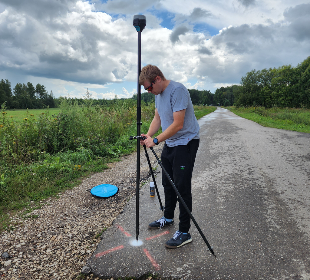
](https://knowledge.topodrone.com/uploads/images/gallery/2024-11/rdvimage.png)

A ground control point made with paint on the pavement is coordinated using the Reach RS2 GNSS receiver.

[![image.png](https://knowledge.topodrone.com/uploads/images/gallery/2024-11/scaled-1680-/TtTimage.png)
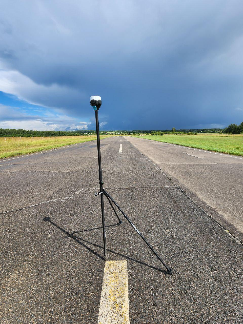
](https://knowledge.topodrone.com/uploads/images/gallery/2024-11/TtTimage.png)

Ground control point of road markings, coordinated by the Reach RS2 GNSS receiver.

[![image.png](https://knowledge.topodrone.com/uploads/images/gallery/2024-11/scaled-1680-/gqmimage.png)
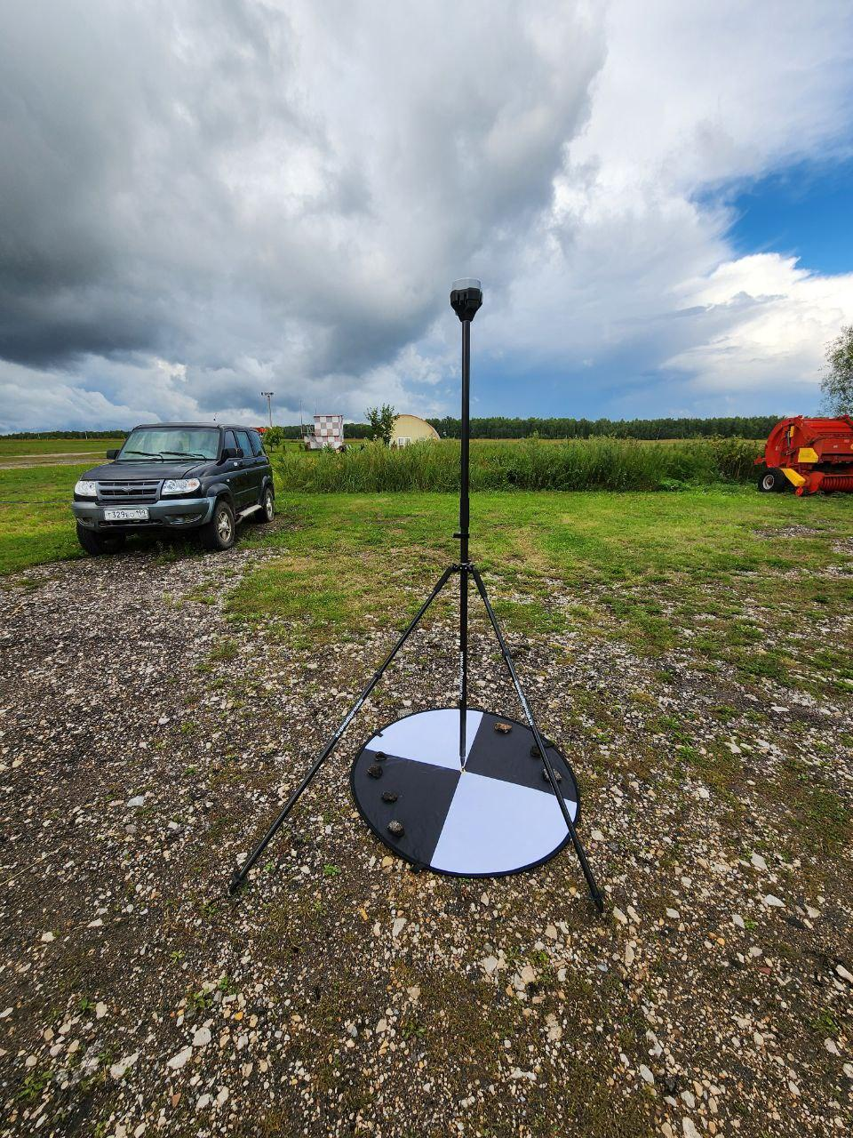
](https://knowledge.topodrone.com/uploads/images/gallery/2024-11/gqmimage.png)

The ground control point, made of a folding identification sign, is coordinated by the Reach RS2 GNSS receiver.