
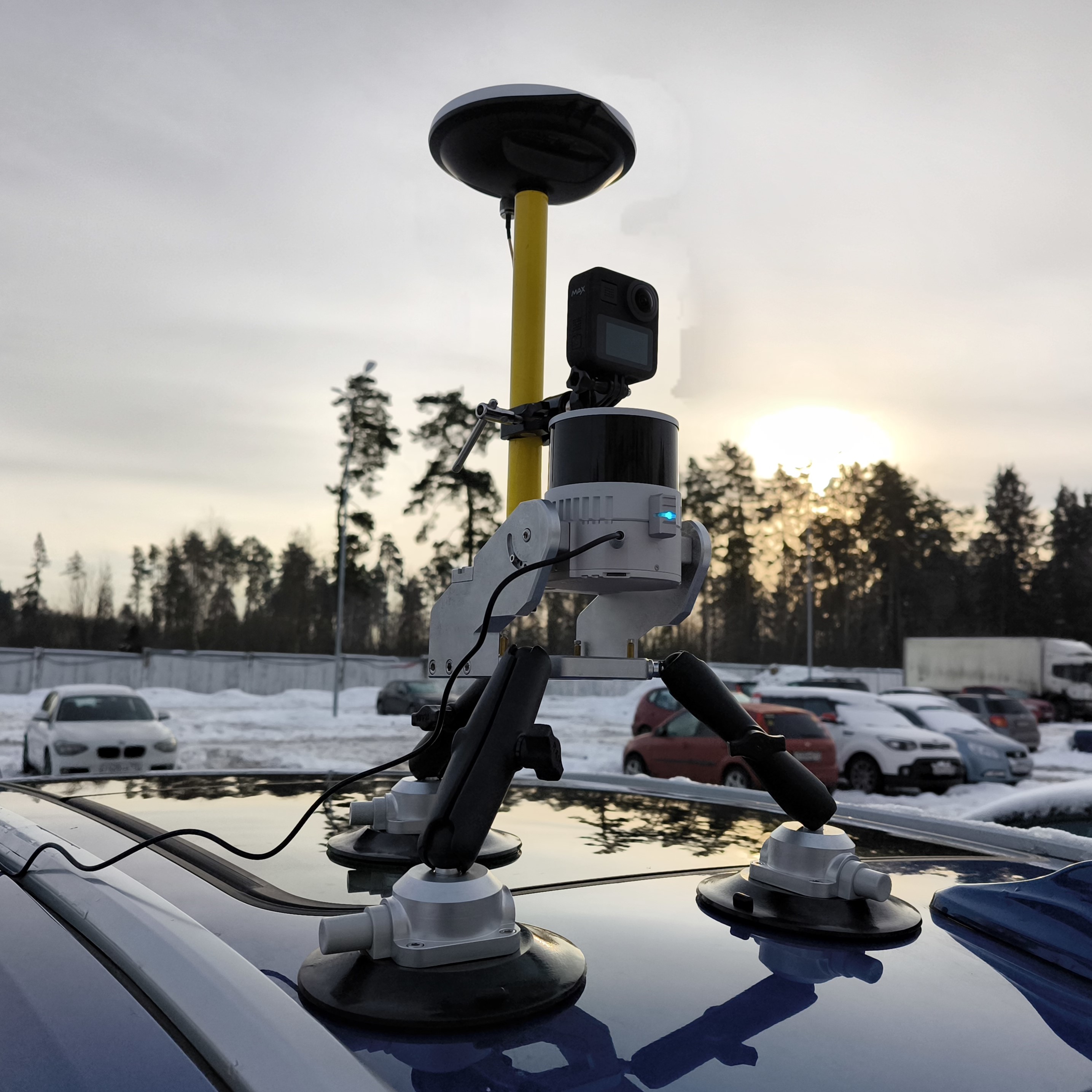
Switching on and initializing the TOPODRONE laser scanner
After correct installation on the drone or backpack, connection of external GNSS antenna and power cable, TOPODRONE laser scanner performs the power-up and initialization procedure. After initialization the data recording starts on the internal storage medium of the laser scanner or on the external memory card if it is installed in the scanner (priority of recording on the external memory card). For successful initialization it is necessary to ensure proper installation of the TOPODRONE laser scanner on the appropriate media, the presence of GNSS signal, as well as immobility of the device before the start of data recording.
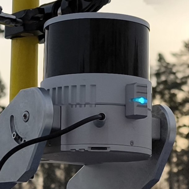
After connecting the TOPODRONE laser scanner to the power supply, it will emit a short beep and the LED will turn green. Then, the LED of the laser scanner will light up according to the indication table. If there is a stable GNSS signal and there are no errors, the laser scanner will switch the LED color to constant blue after some time. After this happens, the data are recorded into the internal memory of the TOPODRONE laser scanner. It is possible to stop data recording by the following events:
- Power interruption
- External media connected (only available when writing data to external media)
- Running out of free space on the storage medium (memory card or internal memory)
|
|
|
The first activation (cold start) of the laser scanner in an open area with a sufficient GNSS signal level (8 or more satellites) may take more time to pass the initialization procedure than subsequent activations. As a rule, at the first start of the TOPODRONE laser scanner it takes no more than 60 seconds until the start of data recording. In case of subsequent power-ups (warm start) the initialization procedure is faster (20-30 seconds). In case of starting to move along the route, initialization may not be performed correctly during the movement.
It is necessary to check the LiDAR initialization status each time before launching the drone on an automatic mission or starting a walking route, as well as before finishing the work. In case the initialization status at the end of the route is not displayed by the constant LED, it means that the GNSS signal was lost during the route. In this case, the data received from the TOPODRONE laser scanner will be unsuitable for further post-processing.