One vector
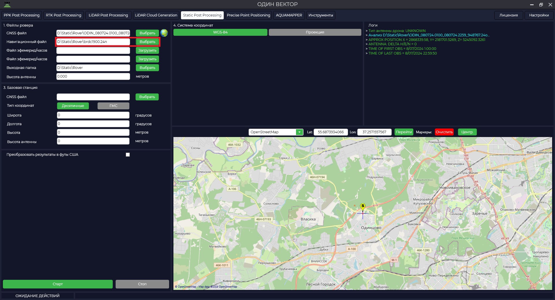
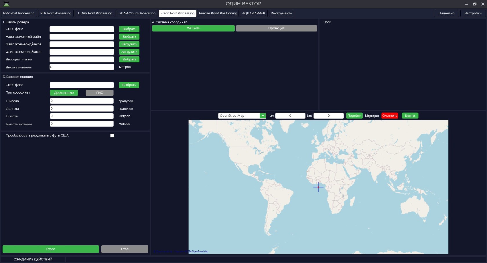
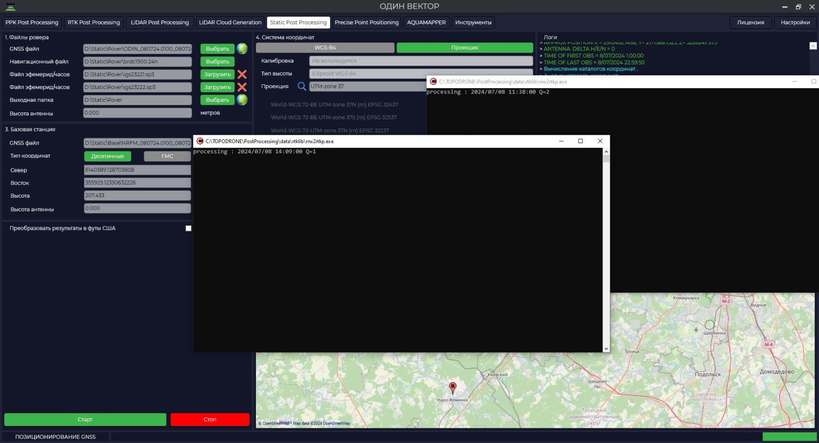
ДляToзапускаstartданногоthisмодуляmoduleнеобходимоitоткрытьisпрограммуnecessary to open the TOPODRONE Post Processingперейтиprogram,наgoвкладкуto the Static Post Processingиtabнажатьandнаclickкнопкуon«Одинtheвектор»."One vector" button.

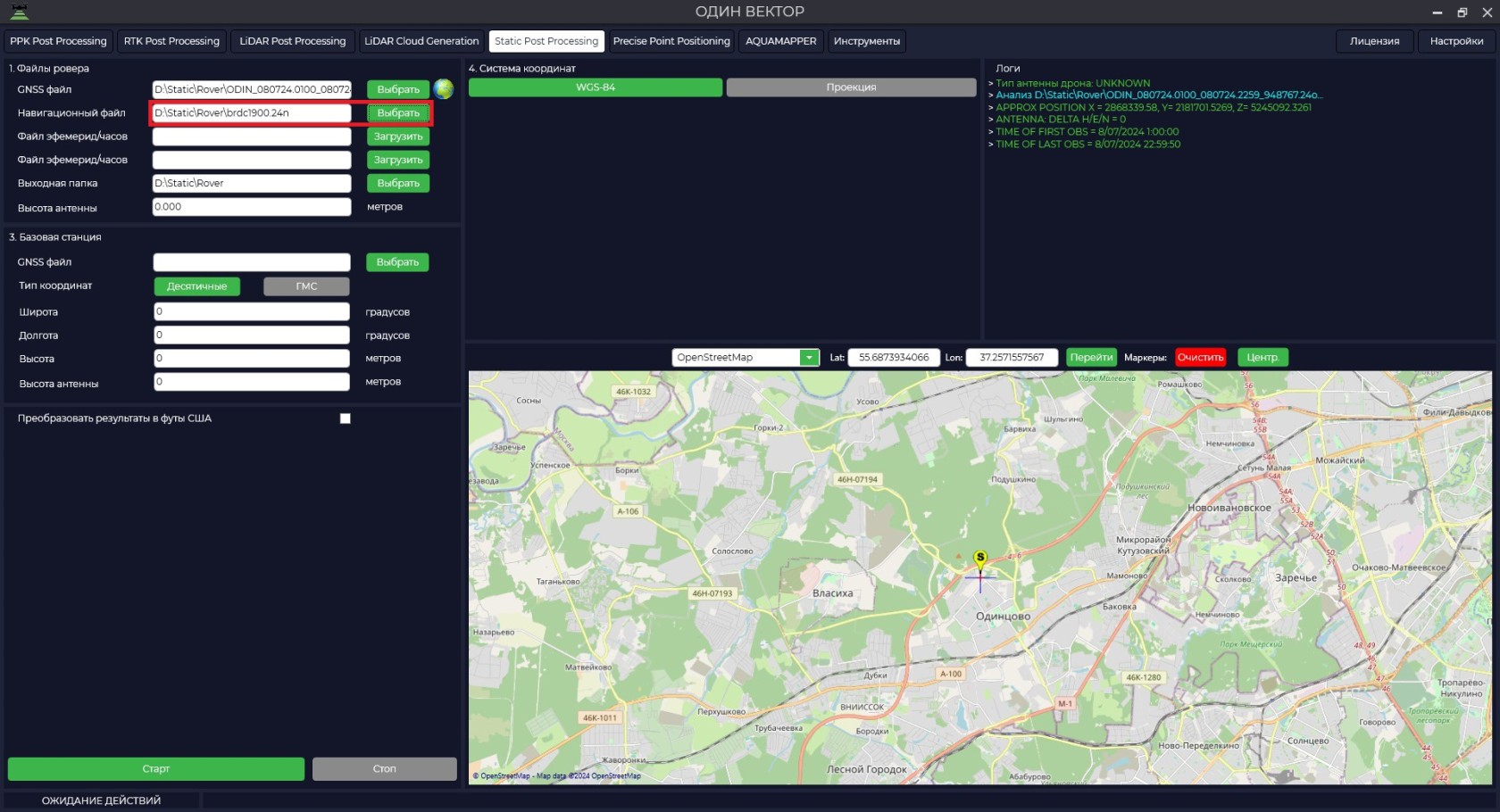
ЗагрузитLoadданныеmeasurementизмеренийdataсfromровера.the rover.

ЗагрузитьDownloadданныеairborneбортовыхephemerisэфемерид.data.
-
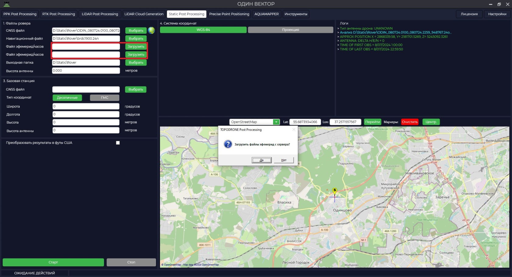
ПриIfнеобходимостиnecessary,загрузитьdownloadфайлыfilesточныхofэфемерид.accurate ephemeris.

-
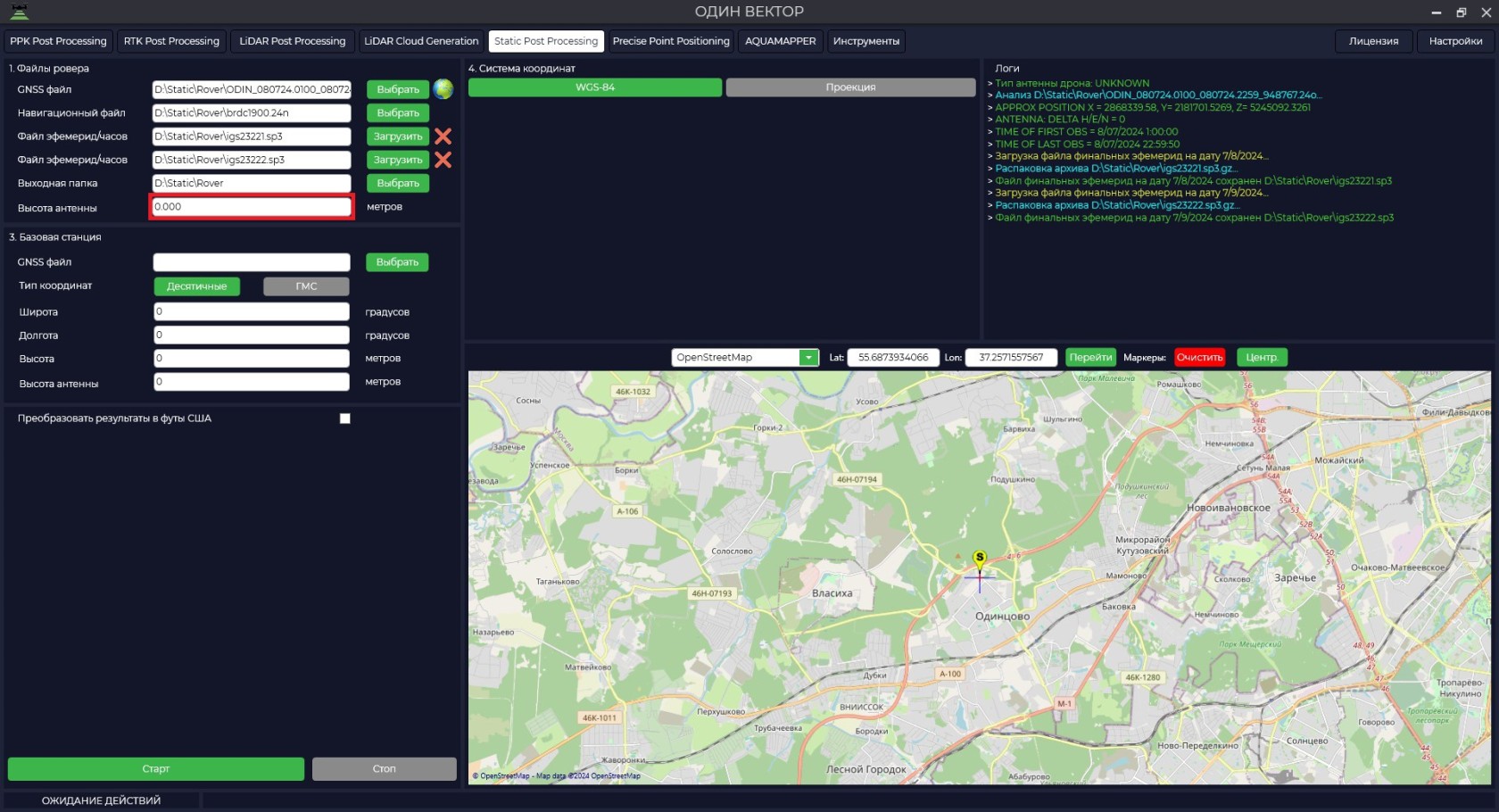
ВвестиEnterвысотуtheантенныheightровера.of the rover antenna.
ВысотаTheантенныheightвключаетofвtheсебяantennaвысотуincludesвехиtheилиheightштативаofотtheизмеряемогоmilestoneпунктаorдоtripodнизаfromкрепленияtheприемникаmeasuringиpointвысотуtoотtheнизаbottomкрепленияofприемникаtheдаreceiverфазовогоmountцентра.and the height from the bottom of the receiver mount to the phase center.
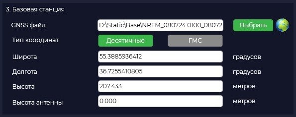
ЗагрузитьDownloadданныеmeasurementизмеренийdataсfromбазовойtheстанции.base station.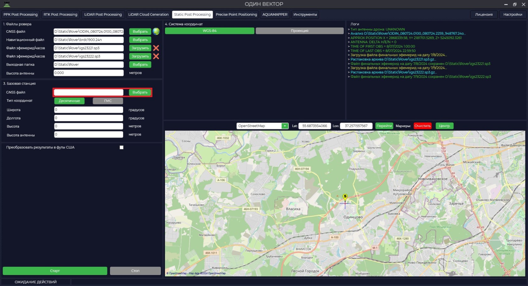

ПослеAfterзагрузкиtheфайлов,filesнажавareнаuploaded,кнопкуpressing
можнопроанализироватьbuttonкачествоallowsданных.
ПрограммаTheавтоматическиprogramподгрузитwillкоординатыautomaticallyиloadвысотуtheбазовойcoordinatesантенныandизheight of the base antenna from the Rinexфайла,file,приtakingучете,intoчтоaccountонаthatбылаitвнесенаwasприenteredизмеренииduringиmeasurementотобразитandместоdisplayрасположенияtheнаlocationкарте.on the map.

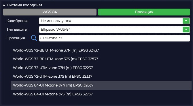
ВInслучае,caseеслиyourвашаcoordinateсистемаsystemкоординатisотличаетсяdifferentотfrom WGS-84,вамyouнеобходимоneedнажатьtoкнопкуclick«Проектция»"Projection"иbuttonвыбратьandизselectпредложенногоyourспискаcoordinateвашуsystemсистемуfromкоординатtheилиlistввестиorназваниеenterсистемыtheкоординатcoordinateвsystemстрокеnameпоиска,inприtheнеобходимостиsearchвыберитеline,модельifгеоида.necessary,Еслиselectвашейtheсистемыgeoidкоординатmodel.нетIfвyourсписке,coordinateтоsystemвыisсамиnotможетеinеёtheдобавитьlist,вyouпрограммуcan add it to TOPODRONE PostProcessing.Processing program.

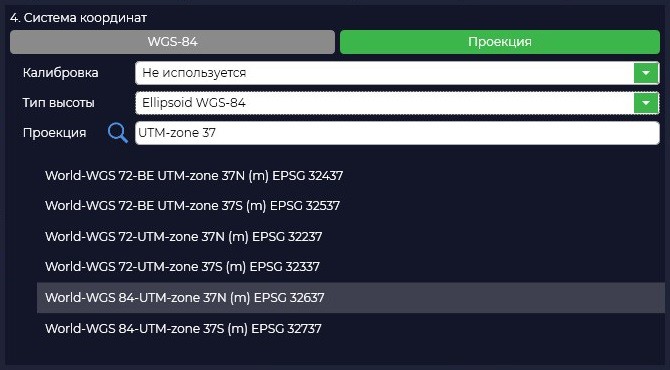
ПриSelectingвыбореaсистемыcoordinateкоординатsystemпроизойдетwillконвертацияconvertизfrom WGS-84вtoвыбраннуюtheвамиprojectionпроекцию.ofПриyourнеобходимостиchoice.скорректируйтеIfкоординатыnecessary,базовойcorrectстанции.the coordinates of the base station.
ВысотаTheантенныheightвключаетofвtheсебяantennaвысотуincludesвехиtheилиheightштативаofотtheпунктаmilestoneсorизвестнымиtripodкоординатамиfromдоtheнизаpointкрепленияofприемникаknownиcoordinatesвысотуtoотtheнизаbottomкрепленияofприемникаtheдаreceiverфазовогоmountцентра.and the height from the bottom of the receiver mount to the phase center.

ПослеAfterнажатииpressingкнопкиthe«Старт»"Start"программаbutton,преступитtheкprogramрасчетам.will proceed to calculations.

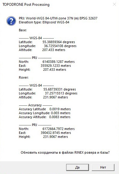
ПоUponокончаниюcompletionрасчетовofпрограммаcalculationsвыдастtheокноprogramсwillкоординатамиdisplayбазовойaстанцииwindowиwithровераcoordinatesвofсистемеbaseкоординатstation and rover in WGS-84иcoordinateместнойsystemсистемеandкоординатlocalиcoordinateпредложитsystemсохранитьandэтиwillданныеofferвtoфайлыsaveнаблюденийtheseдляdataдальнейшегоtoиспользованияobservationэтихfilesданных.forТакfurtherжеuseвofпапкеtheseвыходныхdata.данныхAlsoсохранитьсяinфайлtheсoutputрезультатамиdataрасчета.folder the file with the calculation results will be saved.
Caption 
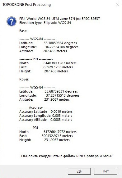
PRJ: World-WGS 84-UTM-zone 37N (m) EPSG 32637
Elevation type: Ellipsoid WGS-84Base:
-------- WGS-84 ---------
Latitude: 55.38859364 degrees
Longitude: 36.72554108 degrees
Altitude: 207.433 meters---------- PRJ -----------
North: 6140389.1287 meters
East: 355929.1233 meters
Height: 207.433 metersRover:
-------- WGS-84 ---------
Latitude: 55.68739331 degrees
Longitude: 37.25715513 degrees
Altitude: 231.9067 meters------- Accuracy --------
Accuracy Latitude 0.0019 meters
Accuracy Longitude: 0.003 meters
Accuracy Altitude: 0.0083 meters---------- PRJ -----------
North: 6172664.7972 meters
East: 390432.9745 meters
Height: 231.9067 meters