One vector
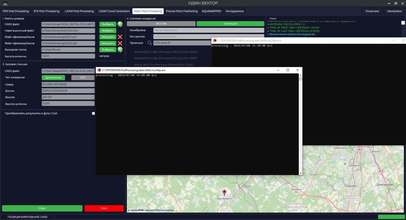
- To start this module it is necessary to open the TOPODRONE Post Processing program, go to the Static Post Processing tab and click on the "One vector" button.


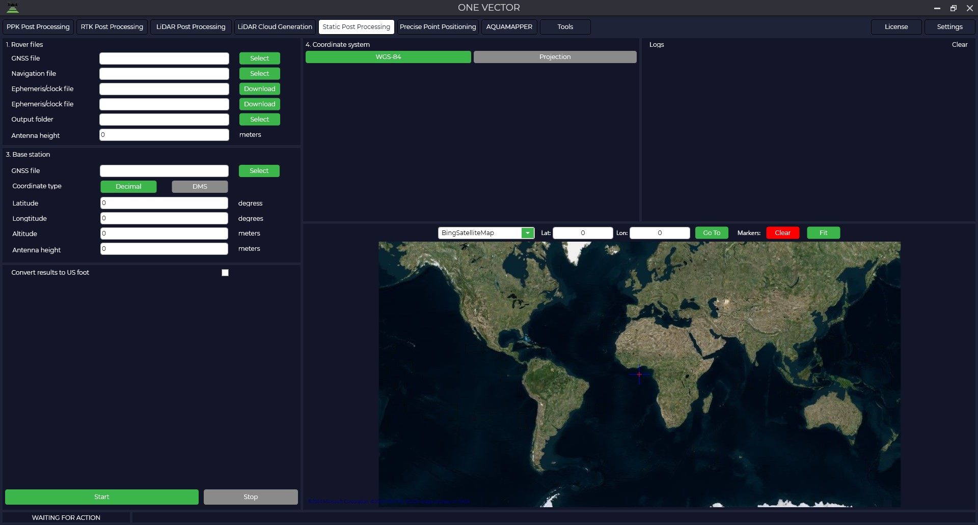
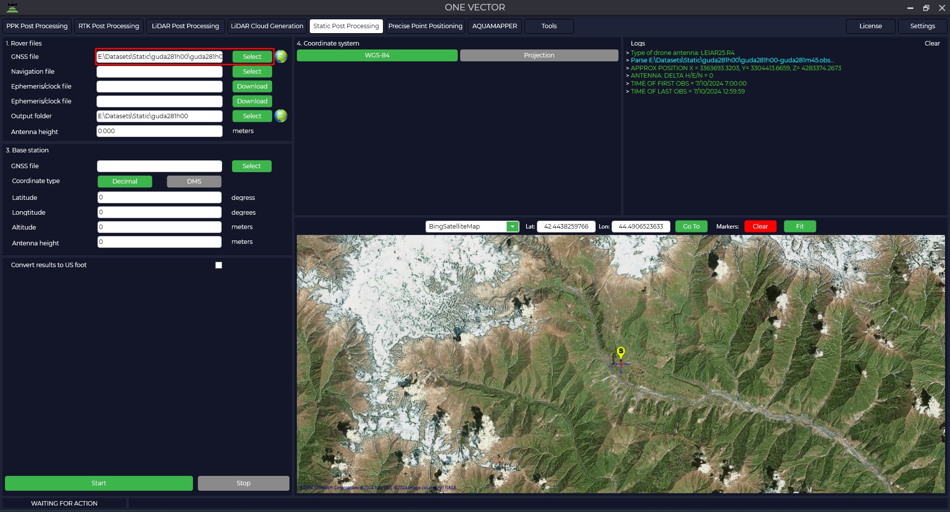
- Load measurement data from the rover.


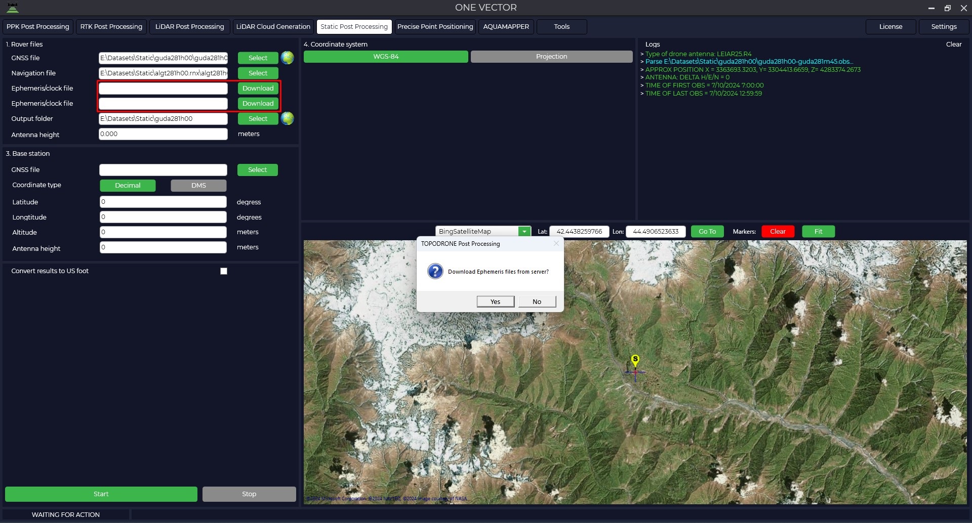
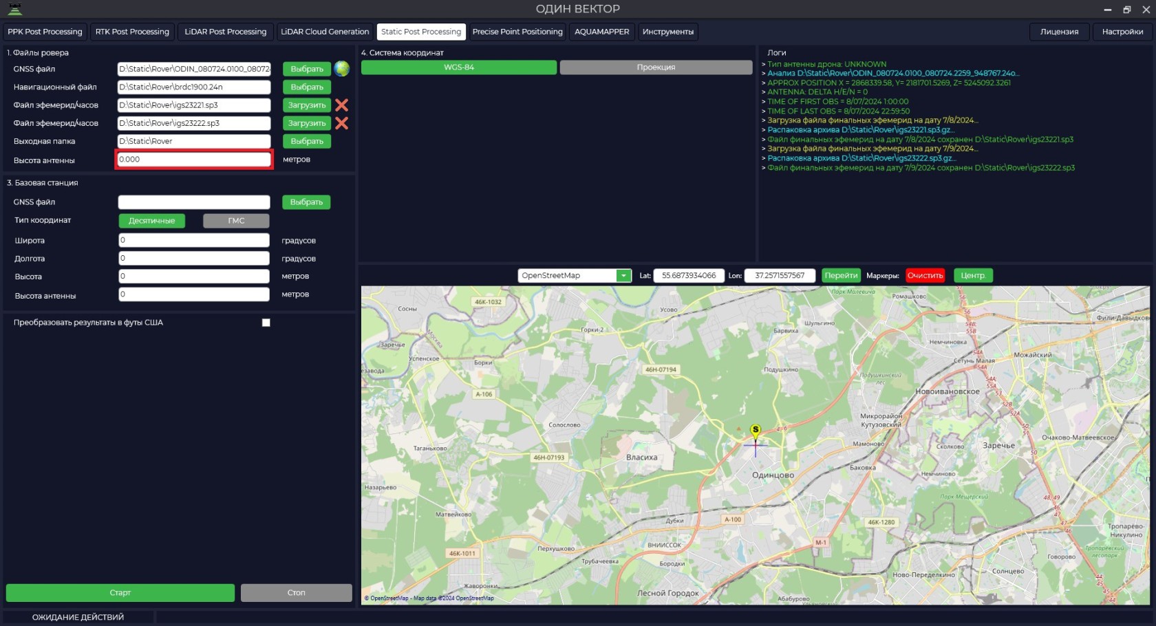
- Download airborne ephemeris data.
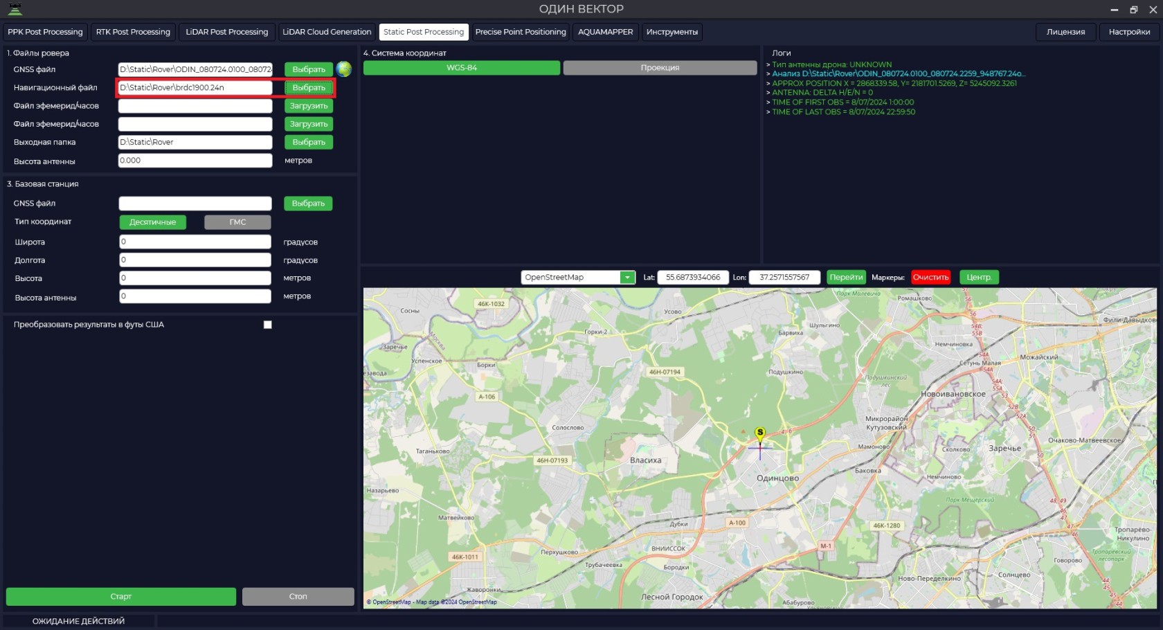


The height of the antenna includes the height of the milestone or tripod from the measuring point to the bottom of the receiver mount and the height from the bottom of the receiver mount to the phase center.
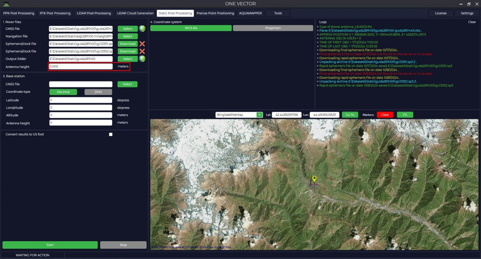
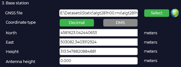
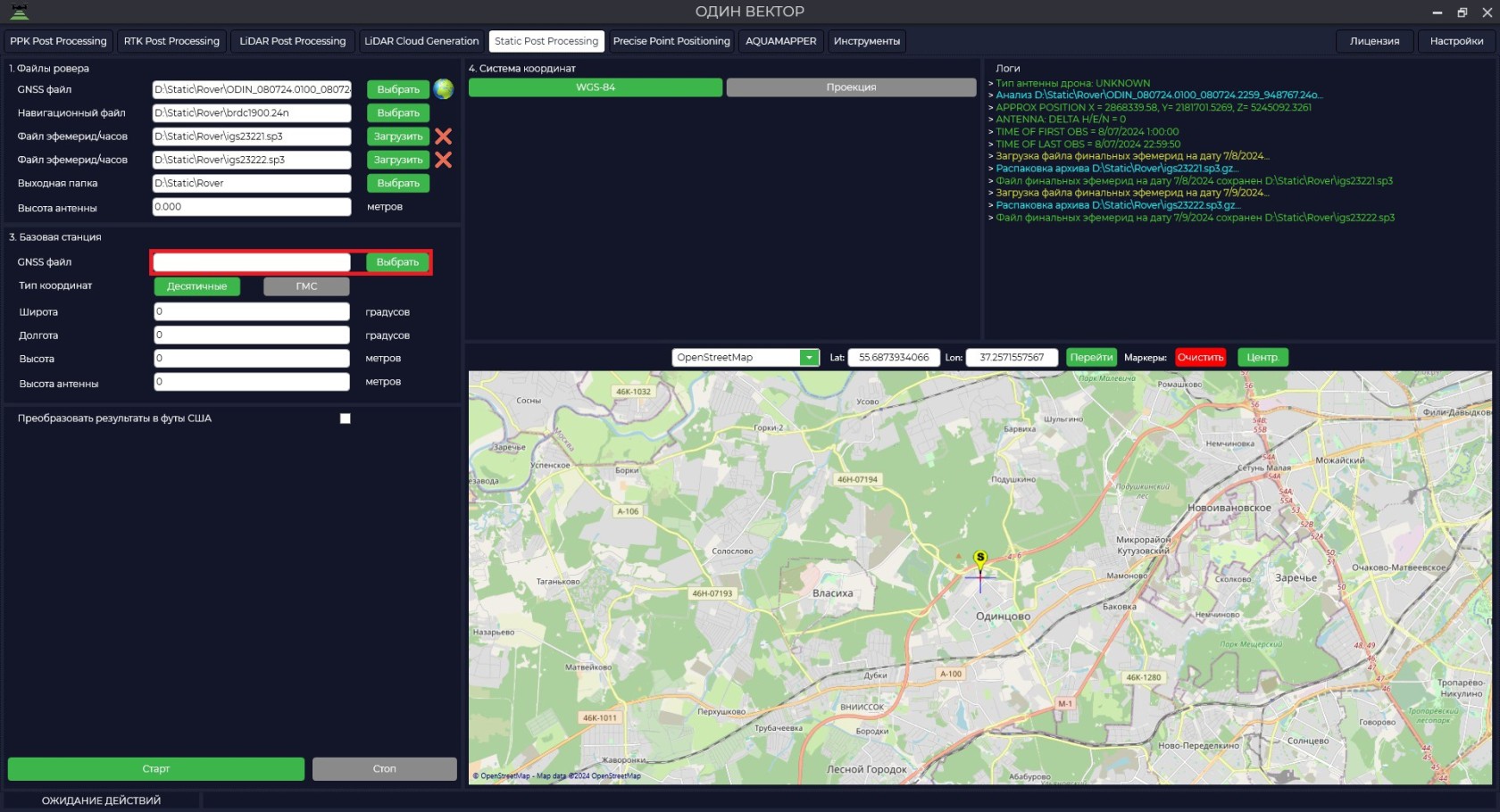
- Download measurement data from the base station.

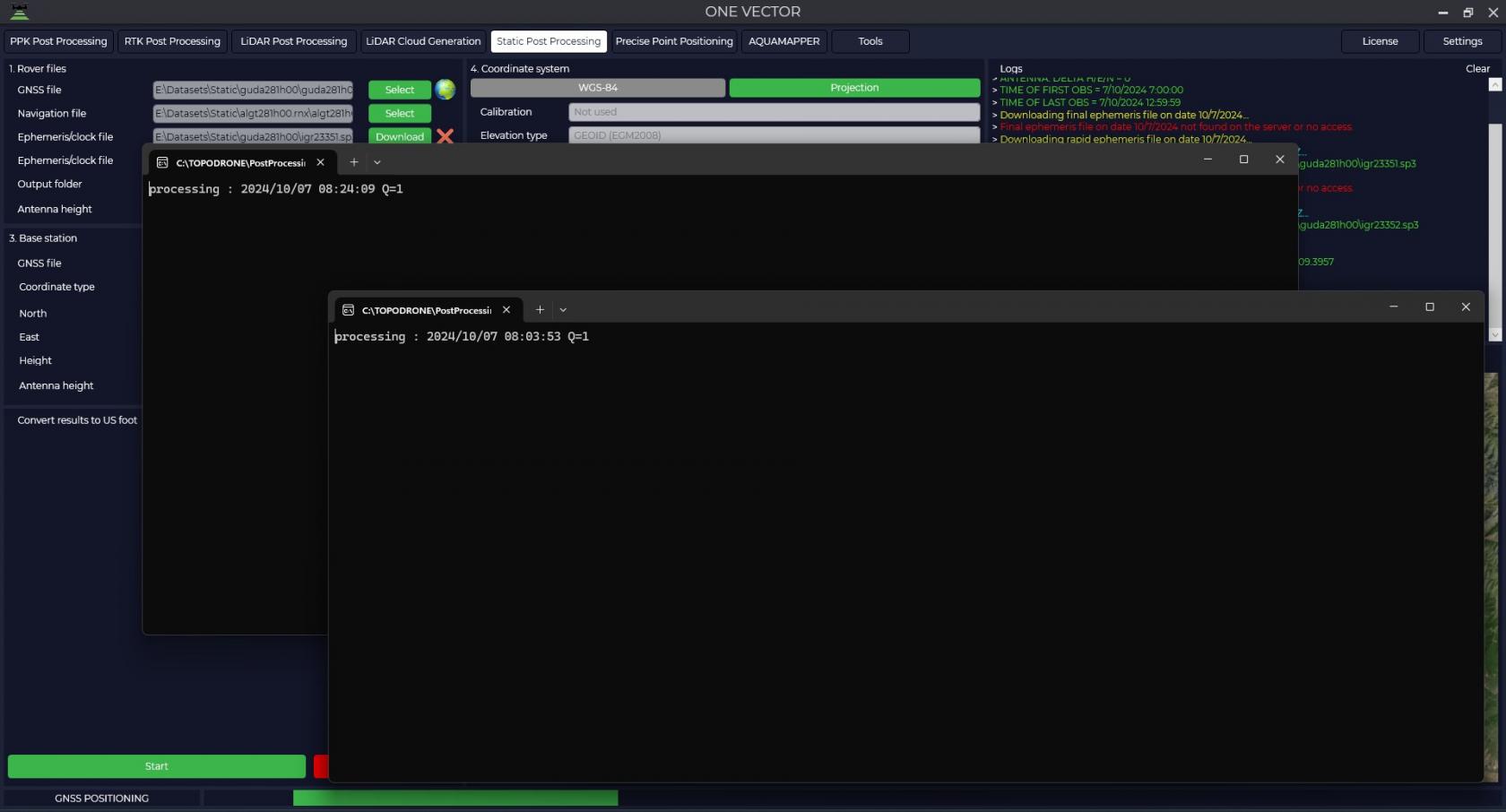
- After the files are uploaded, pressing the
 button allows you to analyze the quality of the data.
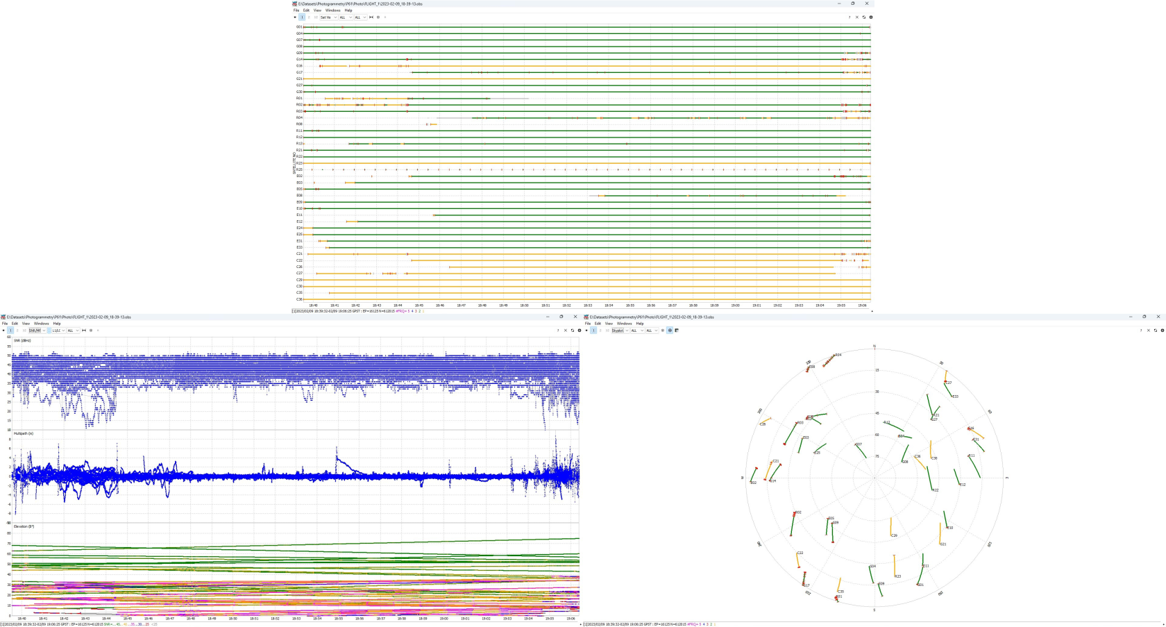
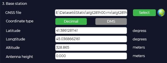
- The program will automatically load the coordinates and height of the base antenna from the Rinex file, taking into account that it was entered during measurement and display the location on the map.

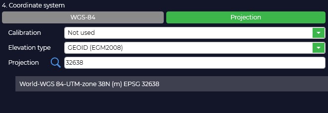
- In case your coordinate system is different from WGS-84, you need to click "Projection" button and select your coordinate system from the list or enter the coordinate system name in the search line, if necessary, select the geoid model. If your coordinate system is not in the list, you can add it to TOPODRONE Post Processing program.
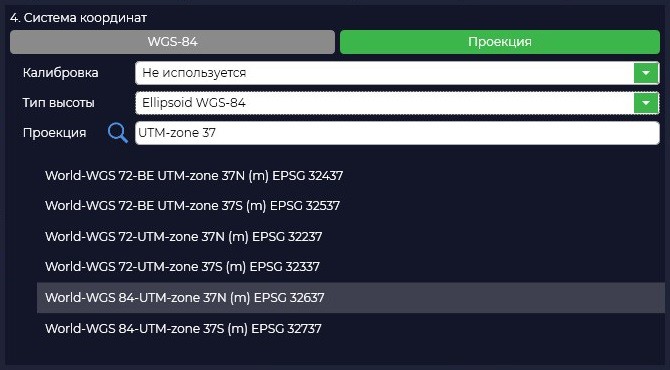
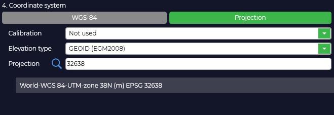
- Selecting a coordinate system will convert from WGS-84 to the projection of your choice. If necessary, correct the coordinates of the base station.
The height of the antenna includes the height of the milestone or tripod from the point of known coordinates to the bottom of the receiver mount and the height from the bottom of the receiver mount to the phase center.
After pressing the "Start" button, the program will proceed to calculations.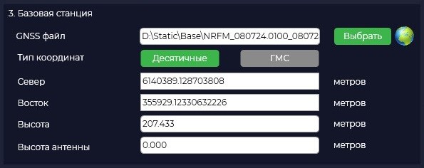

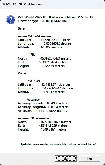
- Upon completion of calculations the program will display a window with coordinates of base station and rover in WGS-84 coordinate system and local coordinate system and will offer to save these data to observation files for further use of these data. Also in the output data folder the file with the calculation results will be saved.
Caption 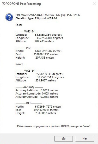
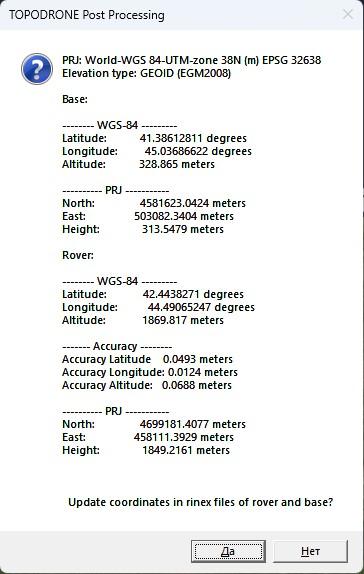
PRJ: World-WGS 84-UTM-zone
37N38N (m) EPSG3263732638
Elevation type:EllipsoidGEOIDWGS-84(EGM2008)Base:
-------- WGS-84 ---------
Latitude:55.3885936441.38612811 degrees
Longitude:36.7255410845.03686622 degrees
Altitude:207.433328.865 meters
---------- PRJ -----------
North:6140389.12874581623.0424 meters
East:355929.1233503082.3404 meters
Height:207.433313.5479 metersRover:
-------- WGS-84 ---------
Latitude:55.6873933142.4438271 degrees
Longitude:37.2571551344.49065247 degrees
Altitude:231.90671869.817 meters
------- Accuracy --------
Accuracy Latitude 0.00190493 meters
Accuracy Longitude: 0.0030124 meters
Accuracy Altitude: 0.00830688 meters
---------- PRJ -----------
North:6172664.79724699181.4077 meters
East:390432.9745458111.3929 meters
Height:231.90671849.2161 meters