TPP v.1.5.2.1 updated 25.07.2025
If the paid technical support period ended before 27.25.07.2025, then this distribution will not work for the user. He will need to either pay for support or download previous distributions, the release date of which is earlier than the paid support period ended.
Get the distribution: TOPODRONE Software Distributor
Added: Fixed bugs, improved security, accelerated operation, added new functionality compared to the previous version.
PPK Post Processing:
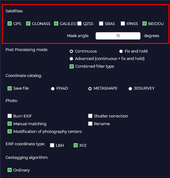
Added support for SWIR camera.

RTK Post Processing:
The photographic centers are adjusted to the offsets from the MRK file.
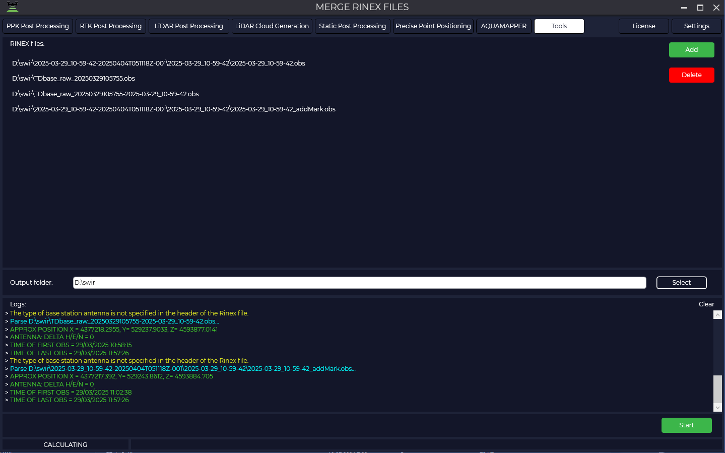
The utility "Merge RINEX files" is now available under the "PRO" license
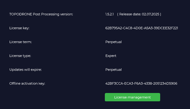
The release date can now be seen on the license information page:
Updated antenna file -> igs20_2353.atx
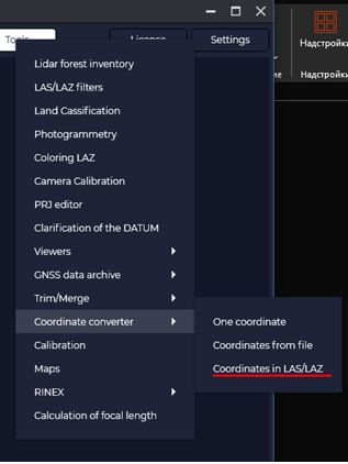
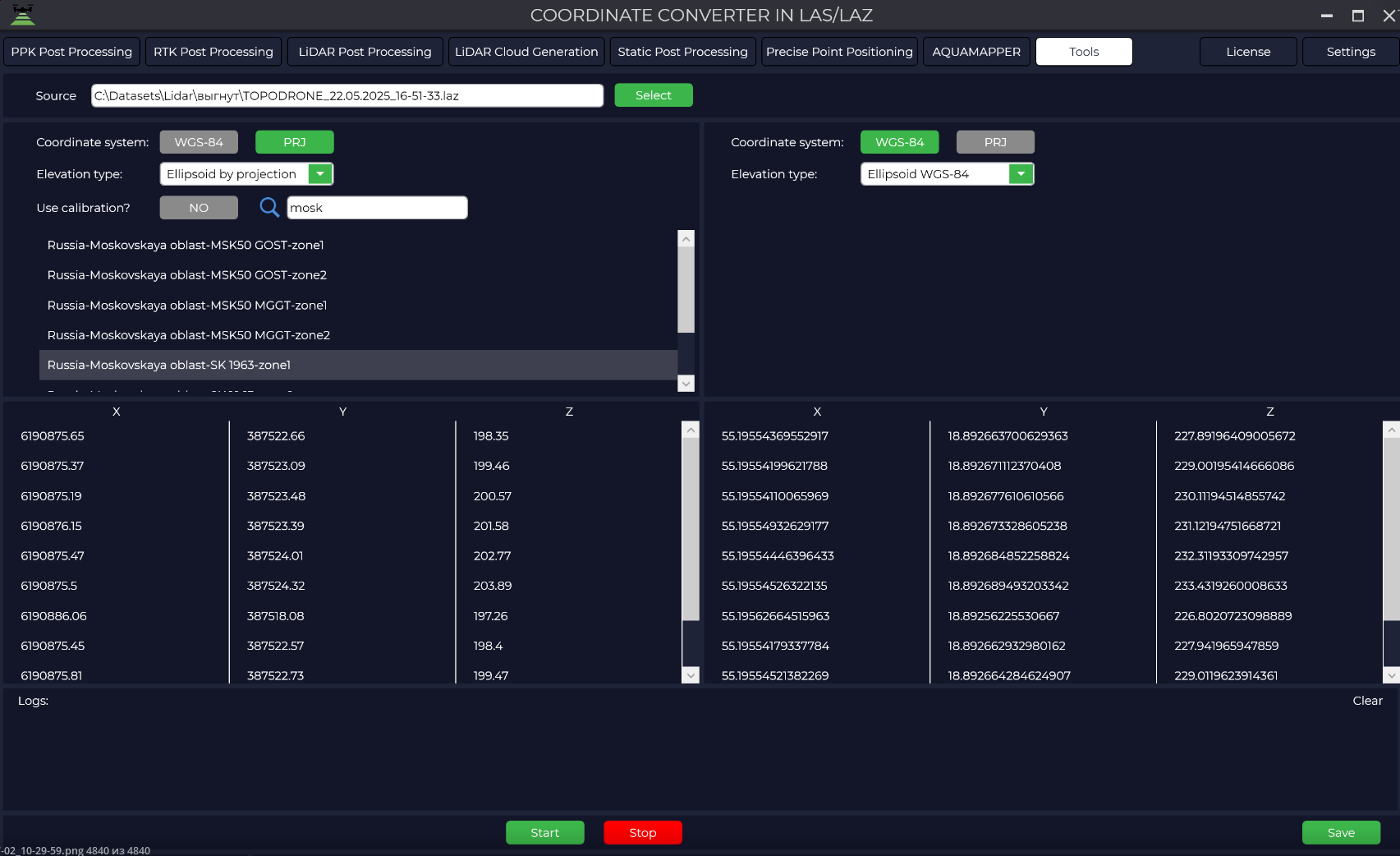
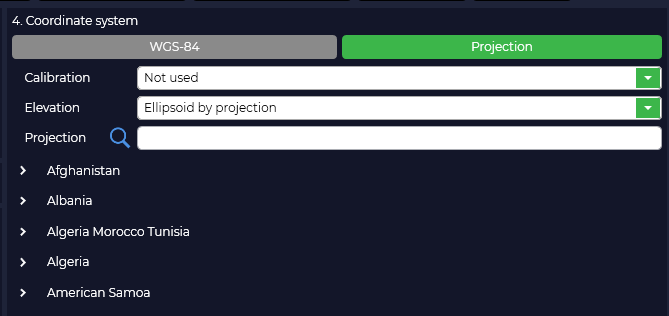
New utility for transforming point clouds from local/wgs84 to local/wgs84 coordinate systems:
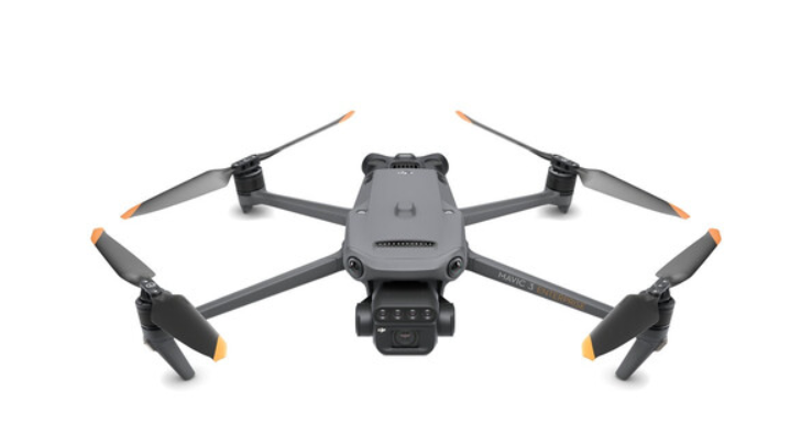
DJI Mavic 3 Multispectral Support:
PPK Post Processing/RTK Post Processing/LiDAR Post Processing:
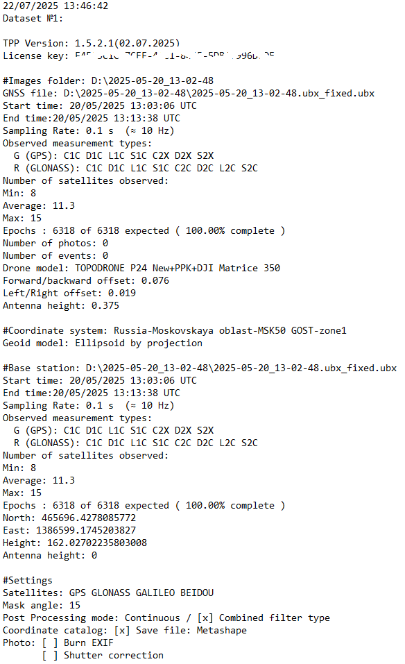
A log file is generated in the output folder for processing analysis or transfer to the technical support service.
PPK Post Processing/RTK Post Processing:
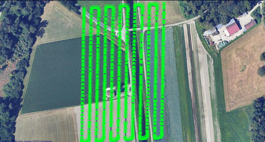
Accelerated display of markers on maps (photography center/GNSS marks/information).
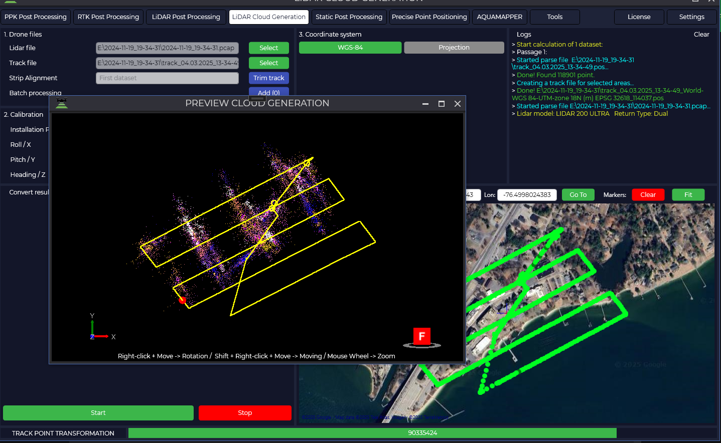
Lidar Cloud Generation:
The calculation of calibration angles has been accelerated. Now the calculation time on the entire track or its part is performed equally in time. Calculated offsets are used for overflights. The lasinfo utility from the LAStools library has been integrated to check the correctness of LAS/LAZ headers. The PRJ information of the coordinate system in which the cloud is calculated is also added to the LAZ/LAS header.
Общее:
Speeded up loading of PRJ (about 6000 files) when starting the program.
Added the ability to disable GPS grouping when calculating GNSS. Frequency trimming (L1/L2...) has been removed from the interface. All frequencies are included in the calculation.