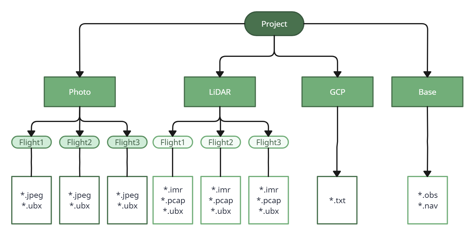
Preparation of initial data
After allcompletion of the field workworks, has been done, before proceedingprior to RAW data processing, it is necessary to structure allorganize the dataachieved obtained, for this purpose:dataset:
- Download
allthe data to your computer. Photos from the camera and GNSS files from theGNSSPPKreceivermodule of the aircraft; Data from the TOPODRONElaser scanner;LiDAR;
*.pcap –laser scannerLiDAR sensor file
*.imr –file from thelaserLiDARscanner'sIMUinertial(InertialsensorMeasurement Unit)
*.ubx – raw measurement file from thelaserPPKscannerUpgradeGNSSkit or built-in LiDAR PPK (GNSS) receiver
log.txt –logsLiDARfromsystemtheloglaserdata,scanner, they do notdoesn't take part inprocessing,processing stage, butthey arenecessary fordiagnostics.diagnostics
*.raw –fileLiDARforsystemlaserdiagnosticsscanner diagnostics,data, not included in processing
*.ubx/.obs/.22O/etc. - Static observation files from the base station;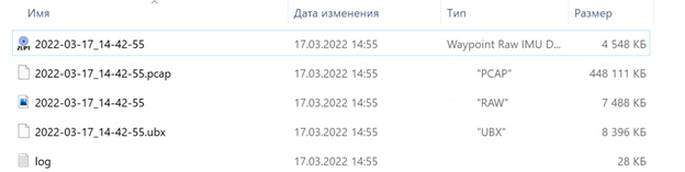
Data set of a single activationSample of the TOPODRONElaserLiDARscanner.single dataset.
*.txt/.csv/etc. - Catalog of control point coordinates. - Distribute
eachthe datatypeto a separatefolderdirectories with an appropriatename.names. If you have had multiple flights and/or passes, eachdatadatasetset shouldshall beplacedcopiedinto a separatefolder.folder, accrodingly. AllImagesphotosdatasetareshallplacedbeinseparatedfoldersaccordingontoseparatethe flights,inas well as thesame folders put*.ubx files from these flights, which are on a microSD flash card installed in TOPODRONE PPK Upgrade Kit on the aircraft.
Please note that the photos should be separated exactly by flight. In DJI aircraft, photos are named with a numerical designation from 1 to 999 (For example, DJI_0001.jpg and DJI_0999.jpg), if you have more than 1000 files, the system will start writing the images to a new folder named DJI_0001.jpg
- Be sure to convert the static observation file from the base station to RINEX format and move it to a separate folder,
suchforasexampleBase."Base".
|
|