
External GNSS Antenna Offsets
ВDuring процессеpost-processing постобработкиto иobtain полученияa высокоточнойhigh-precision траекторииtrajectory движенияof летательногоthe аппаратаaircraft, используюthe фазовыйGNSS центрantenna ГНССphase антенны,center однакоis дляused. полученияHowever, координатto фотографийobtain нужноimage использоватьcoordinates, координатыthe центровcoordinates снимков.of Т.к.the этиimage двеcenters точкиmust неbe совпадаютused. междуSince собой,these аtwo имеютpoints некоторыеdo смещения,not которыеcoincide называютсяand офсетамиhave ГНССcertain антенны.
displacements, these displacements are called GNSS antenna offsets.
ДляTo определенияdetermine офсетовthe необходимоoffsets, измеритьit относительноеis смещенияnecessary положенияto фазовогоmeasure центраthe антенныrelative поdisplacement трёмof осям:the antenna's phase center position along three axes: X, YY, иand Z. НаThe схемеdiagram нижеbelow приводитсяshows взаимноеthe расположениеrelative осейarrangement of the X, YY, иand Z.Z
axes.
ЕслиIf центрthe фотографированияimage располагаетсяcenter спереди,is нижеlocated иin левееfront ГНССof, антенныbelow, поand ходуto движения,the тоleft наof этапеthe постобработкиGNSS значенияantenna смещенийalong указываютсяthe вdirection ПОof travel, the offset values during post-processing are entered in the TOPODRONE Post Processing сsoftware какas положительныеpositive значенияvalues (безwithout знакаa -)minus вsign) метрах.in
meters.
ЕслиIf центрthe фотографированияimage располагаетсяcenter сзади,is вышеlocated иbehind, правееabove, ГНССand антенныto поthe ходуright движения,of тоthe наGNSS этапеantenna постобработкиalong значенияthe смещенийdirection указываютсяof вtravel, ПОthe offset values during post-processing are entered in the TOPODRONE Post Processing сsoftware какas отрицательныеnegative значенияvalues (соwith знакомa -)minus вsign) метрах.
in meters.

ОднимOne изconvenient удобныхmethod способовfor измеренияmeasuring офсетовoffsets являетсяis надёжнаяto установкаsecurely БПЛАplace наthe ровномUAV полуon илиa столе,level носомfloor вплотнуюor кtable, ровнойwith вертикальнойits стенеnose помещения.flush Всеagainst необходимыеa измеренияflat вvertical этомwall случаеof будутthe выполнятьсяroom. относительноAll полаnecessary measurements in this case are taken relative to the floor (стола)or иtable) стеныand соответственно.the
wall, respectively.
ЦентрThe фотографированияimage –center этоis геометрическийthe центрgeometric основногоcenter сенсораof фотокамеры,the которыйcamera's находитсяmain наsensor, пересеченииlocated диагоналейat прямоугольногоthe сенсора.intersection
of the diagonals of the rectangular sensor.
МногиеMany производителиphotographic фотооборудованияequipment указываютmanufacturers положениеindicate плоскостиthe матрицыsensor наplane корпусеposition фотоаппарата,on такимthe образомcamera значительноbody, упрощаетсяsignificantly определениеsimplifying положенияthe центраdetermination фотографирования.of Рядомthe наimage примереcenter фотокамерыposition. The adjacent example shows the sensor plane marking on a Sony A7R4 приводитсяcamera. примерIf обозначенияsuch плоскостиa матрицы.mark Еслиis такогоnot знакаpresent, нет,the тоdepth приof снятомthe объективеsensor возможноposition измерениеcan глубиныbe положенияmeasured матрицыwith приa помощиcaliper штангенциркуляor илиruler линейки.after Обязательноremoving необходимоthe проложитьlens. междуIt матрицейis иessential осьюto глубиныplace штангенциркуляa илиlint-free линейкойcloth безворсовуюor тряпочкуa илиsmall небольшойpiece кусочекof салфетки.tissue Послеbetween измеренийthe глубиныsensor плоскостиand матрицыthe удобноmeasuring выполнятьtool's измеренияdepth отrod. краяAfter байонетаmeasuring объективаthe либоsensor доplane пола.
depth, it is convenient to take measurements from the lens bayonet edge to the floor.
ПродуватьIt матрицуis дляrecommended очисткиto отblow ворсинокdust иoff пылиthe рекомендуетсяsensor толькоonly приusing помощиa специальнойspecialized грушиrubber илиblower баллончикаor соcompressed сжатымair воздухомcanister дляfor очисткиcleaning фототехники.photo Неequipment. рекомендуетсяIt дутьis вnot фотокамеруrecommended изоto рта,blow т.к.into вthe результатеcamera этогоwith наyour сенсорmouth, могутas попастьsaliva частичкиparticles слюныmay иland оставитьon разводы.
the sensor and leave stains.
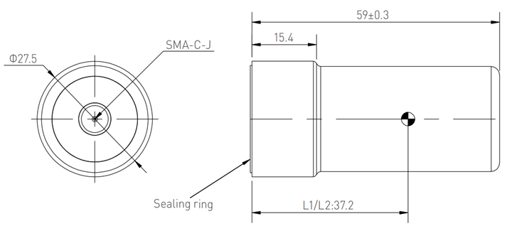
ПоложениеThe фазовогоposition центраof каждойthe моделиphase ГНССcenter антенныdiffers отличается.for Наиболееeach частоmodel используемойof ГНССGNSS антеннойantenna. производителемThe most frequently used GNSS antenna by TOPODRONE являетсяis the Harxon HX-CH6601A. Фазовый центр частот спутникового сигналаThe L1/L2 этойsatellite ГНССsignal антенныfrequency находитсяphase вcenter of this GNSS antenna is located 37 ммmm отfrom нижнейthe плоскостиbottom ровноplane, поexactly центру.at Такимthe образом,center. дляThus, измеренийit офсетовis удобноconvenient измеритьto смещенияmeasure доoffsets основанияto установкиthe ГНССbase антенны.of Еслиthe вGNSS БПЛАantenna совместноmount.
If another model of GNSS antenna is used with the UAV alongside the TOPODRONE UAV PPK UPGRADE KitKit, используетсяthe другаяheight модельof ГНССthe антенны,phase необходимоcenter уточнитьmust высотуbe ФЦverified вin техническойthe документацииmanufacturer's производителя.technical documentation.
  |
  |
ЕслиIf вanother БПЛАmodel совместноof сGNSS antenna is used with the UAV and the TOPODRONE UAV PPK UPGRADE KitKit, используетсяthe другаяheight модельof ГНССthe антенны,phase необходимоcenter уточнитьmust высотуbe ФЦverified вin техническойthe документацииmanufacturer's производителя.technical documentation.