
Setting and coordinating control points
To determine the accuracy of the final point cloud after data post processing, it is necessary to place control points (GCP – Ground Control Points) at the field work stage. Сontrol points - well-defined on the point cloud relative to the relief and pre-coordinated with high-precision GNSS equipment. Control сontrol points are not involved in the processing and should not be confused with reference points. It is recommended to collect at least 3 control points in a section of one drone flight route.
To control the results of the aerial survey, it is recommended to coordinate the control points on any flat surface using GNSS measuring equipment such as a GNSS receiver mounted on a milestone using RTK or PPK methods.
Optimal surfaces for coordinating control points are roads, paths, paved areas and other such features that will be visible from different survey positions.
GCPs can be road marking elements, special folding identification signs or other self-contained signs.
The coordinate system of control points should be the same as the base station phase center coordinate system and the project as a whole.
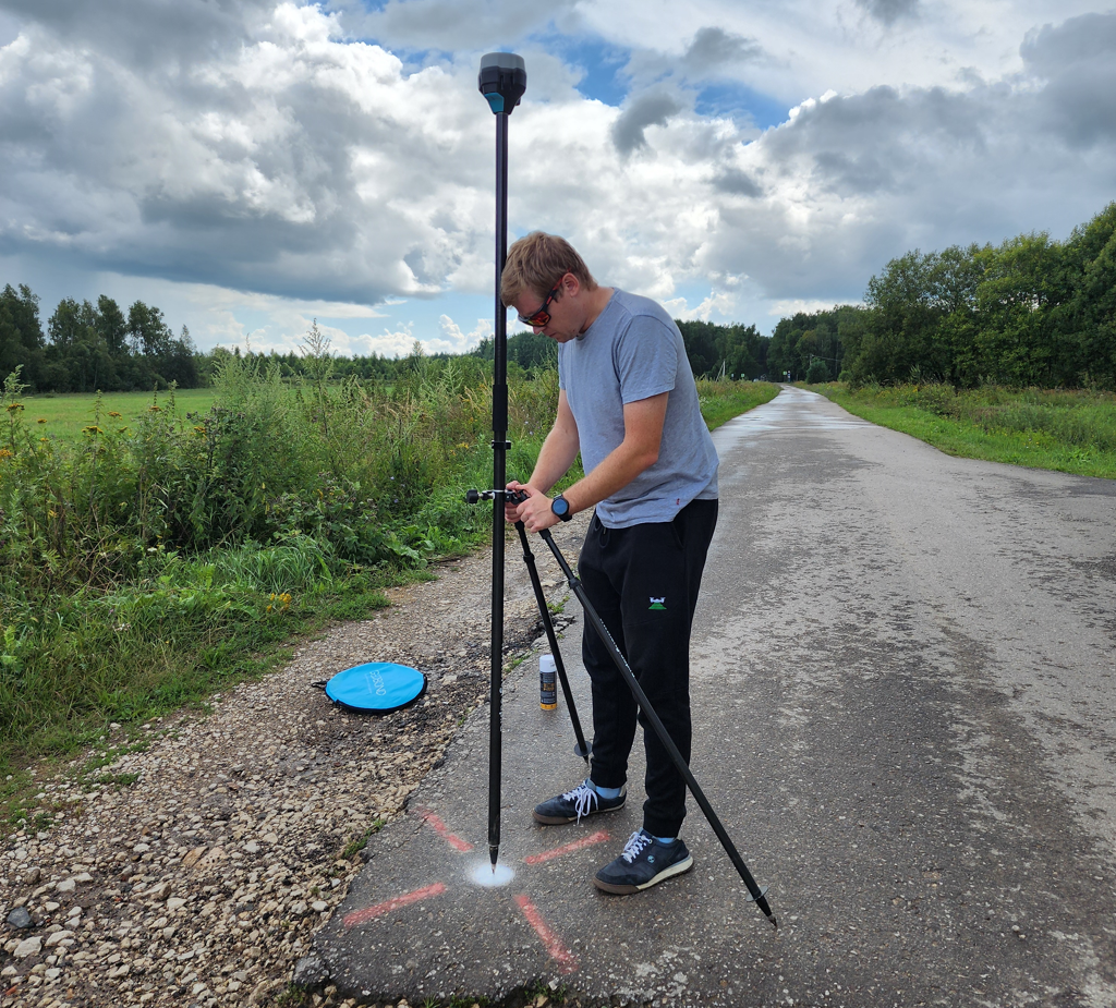
A ground control point made with paint on the pavement is coordinated using the Reach RS2 GNSS receiver.
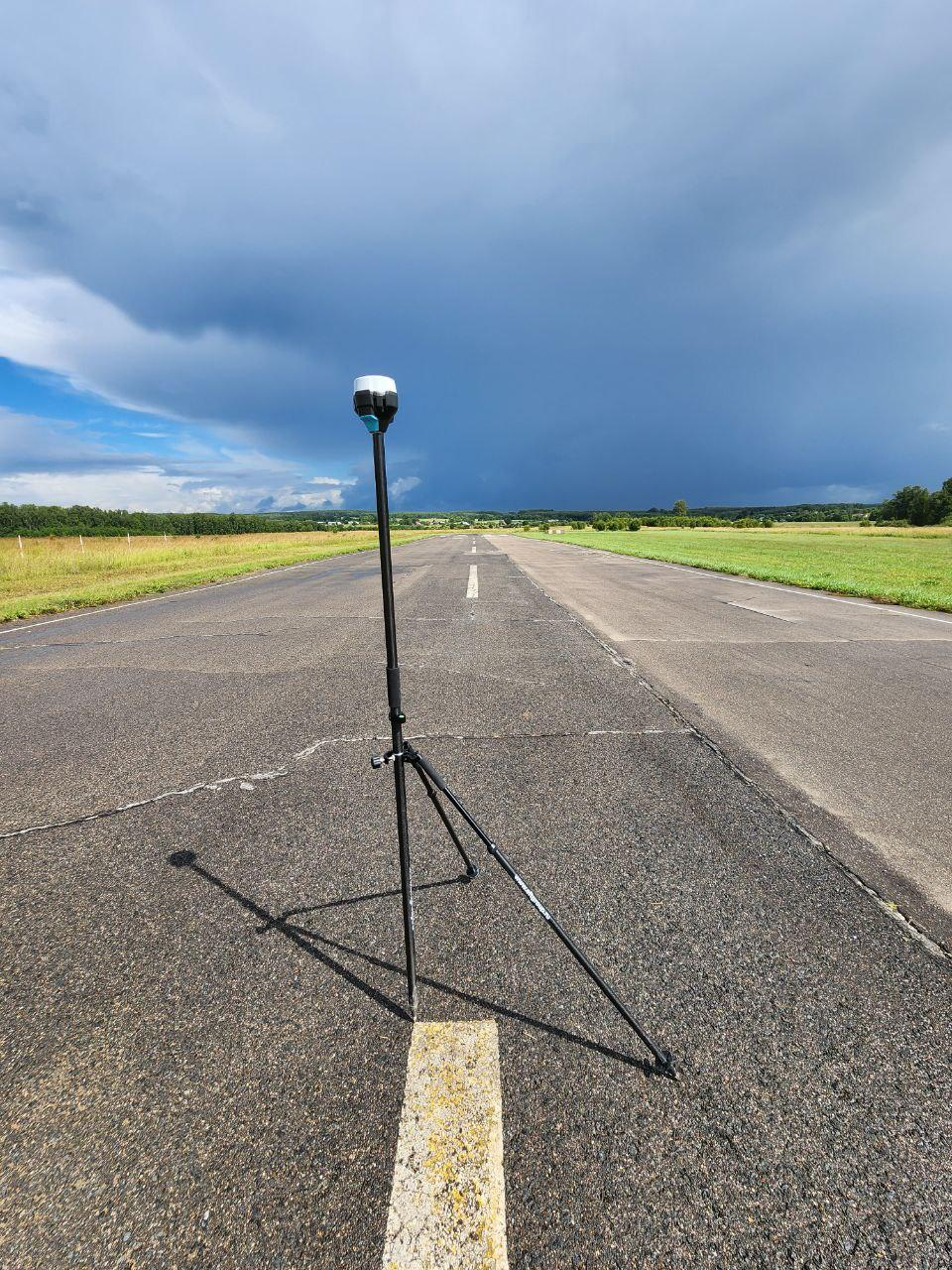
Ground control point of road markings, coordinated by the Reach RS2 GNSS receiver.
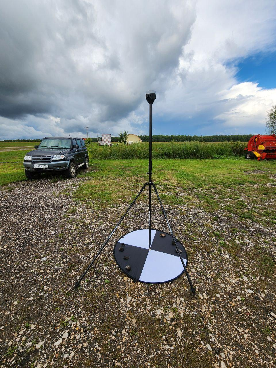
The ground control point, made of a folding identification sign, is coordinated by the Reach RS2 GNSS receiver.
No Comments