
Ground Control Points (GCP) for TOPODRONE LiDAR
To assess the accuracy of the final dense point cloud after data post-processing, it is necessary to perform GCP georeferencing at the fieldwork stage. Under control points we understand the points, which are well interpreted on the dense cloud relative to the relief and previously taken with the help of high-precision GNSS equipment. Control points are not involved in the processing and should not be confused with ground control points.
To control the results of the TOPODRONE LIDAR, it is recommended to place control points on any flat dry surface using GNSS measuring equipment mounted on a milestone or tripod using RTK or PPK methods.
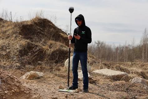
GCP georeferencing to assess the accuracy of the dense point cloud of the TOPODRONE LIDAR using the Reach RS2 GNSS receiver.
The coordinate system of the control points should be similar to the coordinate system of the base station and the project as a whole.
It is recommended that at least 1 control point be recruited on a single ALS route.
The optimal surfaces for coordinating control points are roads, paths and other similar elements.
It is recommended that the control points for ALS in the forest under a cluster of trees should be set in places where the ground has a clear well-defined surface.
No Comments