
AQUAMAPPER
This module is designed for processing data obtained using the TOPODRONE AQUAMAPPER bathymetric scanner. To process the data, follow these steps::
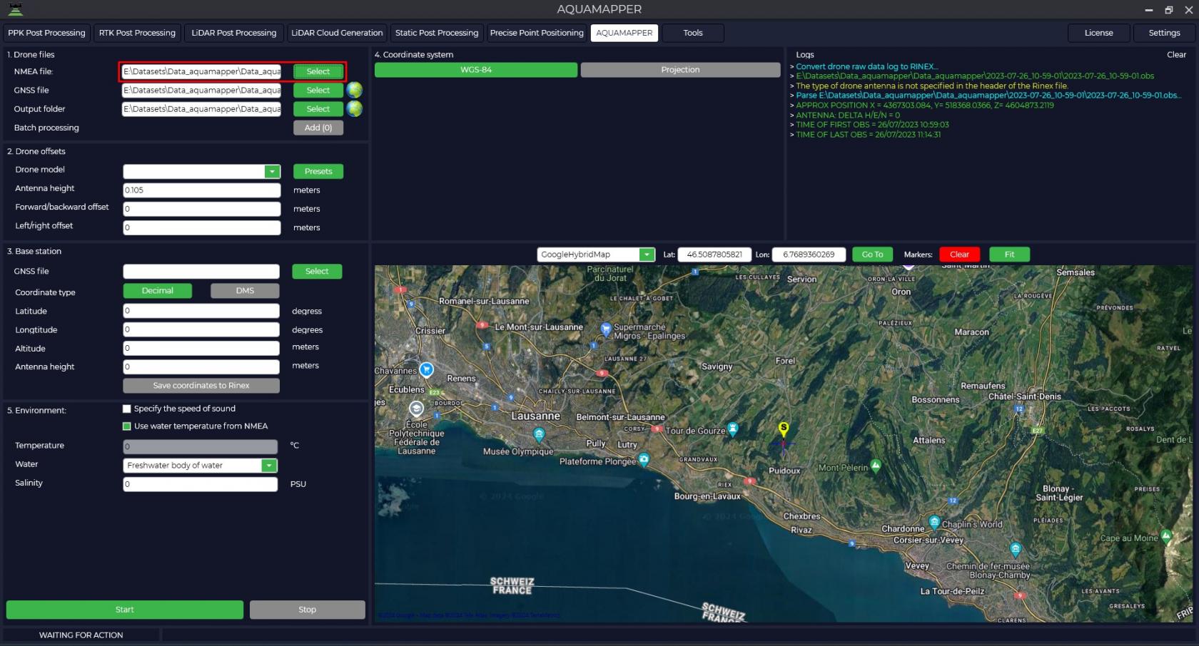
- Launch the TOPODRONE Post Processing program and go to the AQUAMAPPER tab.

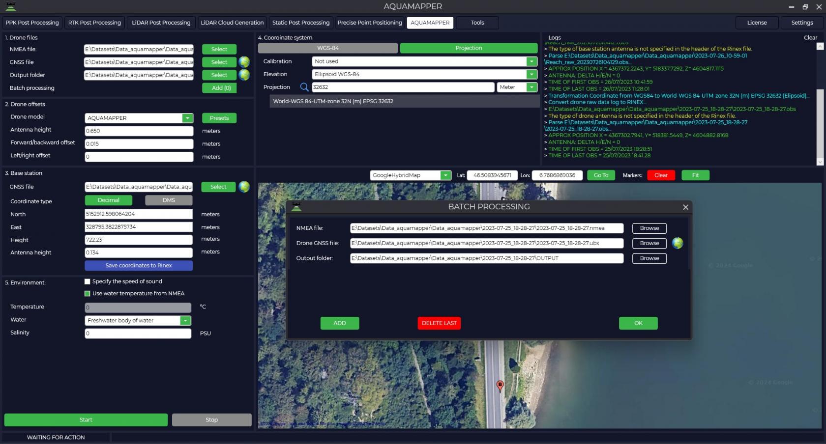
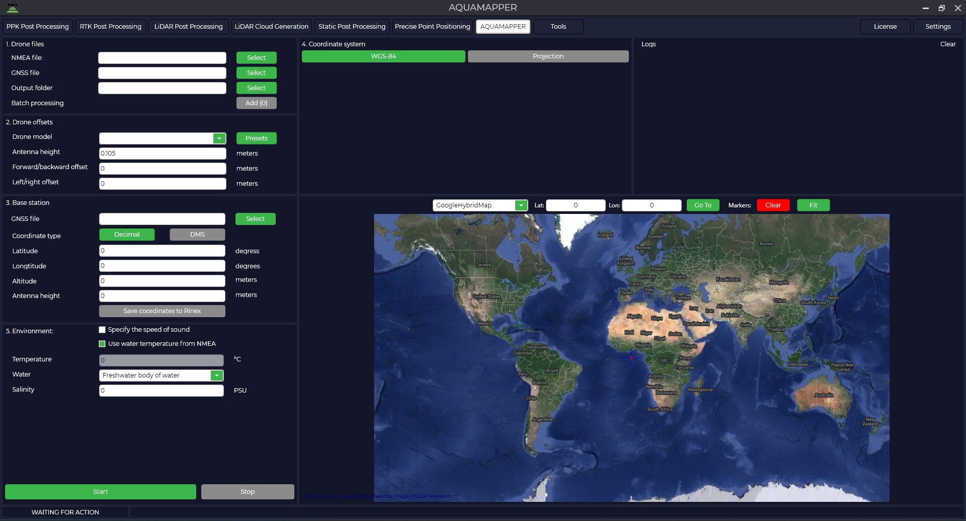
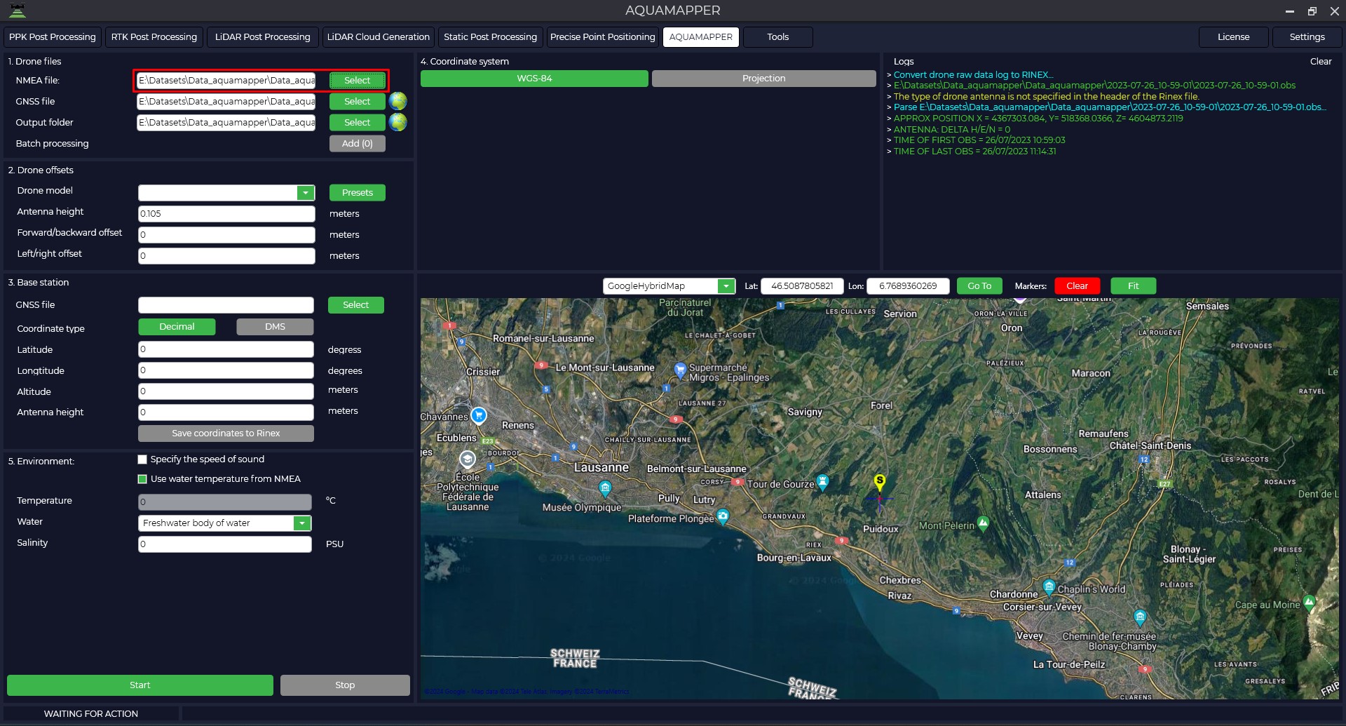
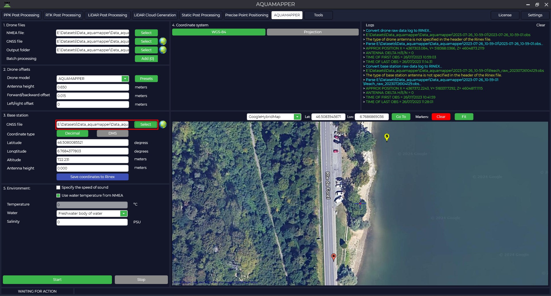
- Select the .nmea file that you received from the bathymetric scanner during data collection. The file from the GNSS receiver will load automatically, and a path to the folder with the processing results will be created.
- By clicking on the button
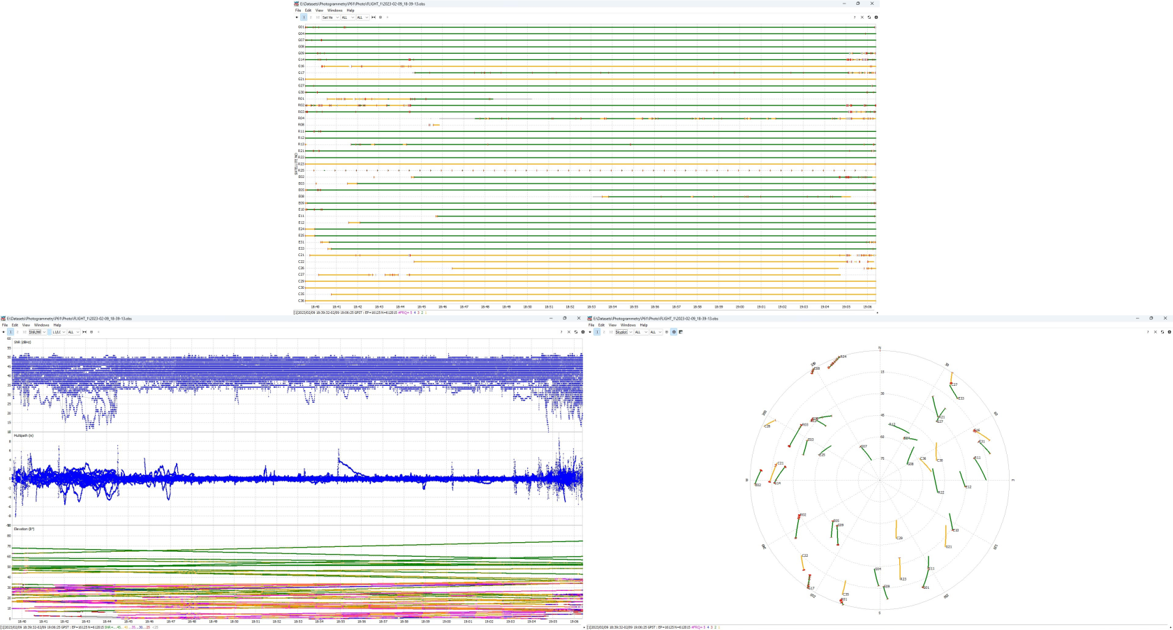
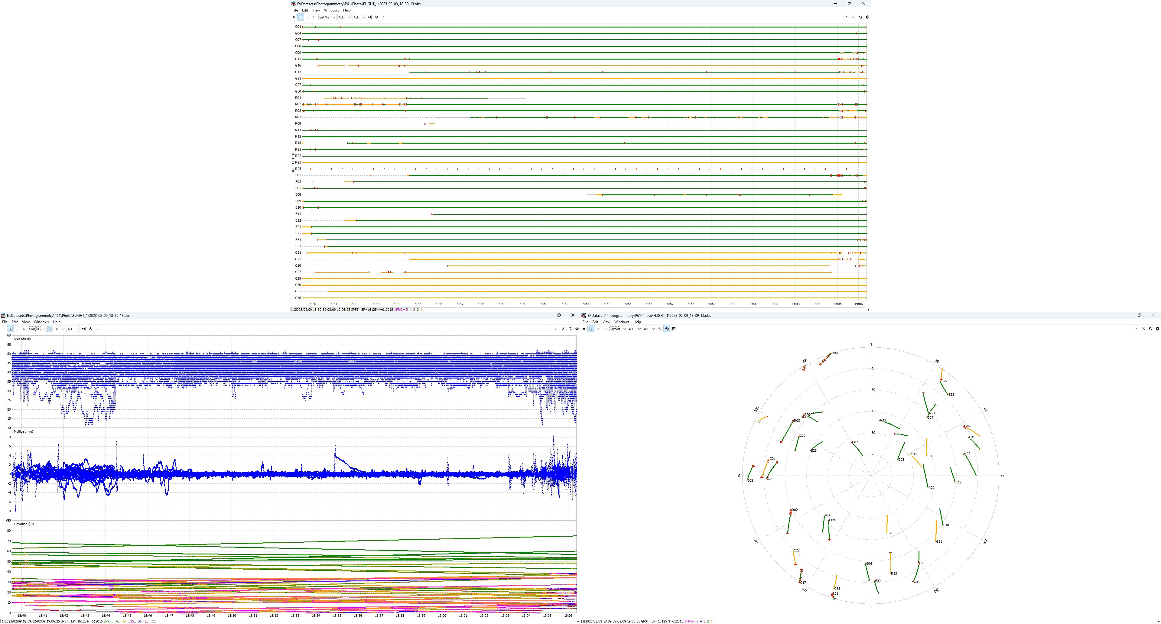
 , you can analyze the data quality. For more information about data quality analysis, see Appendix B.
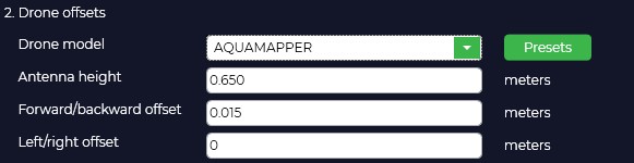
- On the "Drone offsets" tab, if necessary, specify the antenna offset relative to the bathymetric sensor. If necessary, you can add your own data by clicking on the "Presets" button and entering the desired offsets.

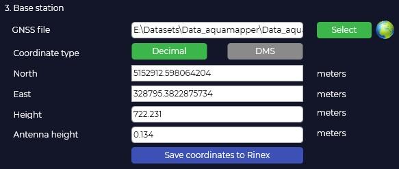
- Select the file from the base station (*. ubx, *obs, *rnx, *YYo). For files in the *rnx and *ubx formats, the conversion process to *obs format will automatically start. The program automatically loads the coordinates of the base station and the height of the base antenna from the Rinex file, if they were specified during the measurement.

The Logs window displays information about the program's actions. Pay attention to the recording time of files from the rover and base station. The base station file must be older than the rover files.
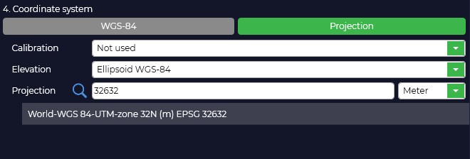
- Select a rectangular coordinate system. To do this, click the "Projection" button and select a coordinate system from the list or enter its name in the search bar.
If the desired coordinate system is not in the list, you can add it to the TOPODRONE Post Processing program. When you select a coordinate system, the conversion from WGS-84 to the selected projection occurs. If necessary, adjust the coordinates of the base station.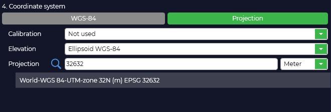
- Change the type of height used. When you select the type, the height will be automatically converted.
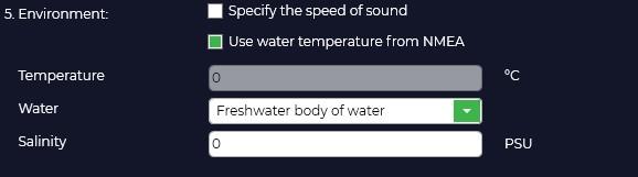
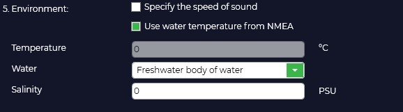
- Specify the environment type. There are two options: specify the speed of sound for correct calculation, or specify the salinity of the reservoir and its temperature. The temperature can be taken from the bathymetric sensor by checking the box "Use water temperature from NMEA".
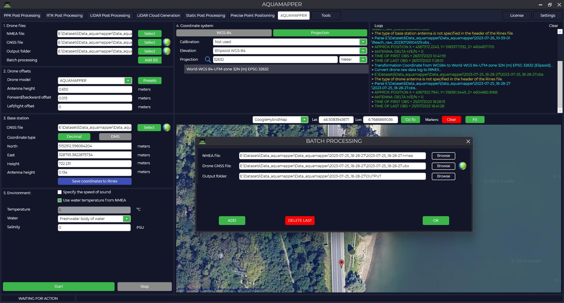
- The TOPODRONE Post Processing program allows you to process multiple data sets from a single base station within a single observation session. For batch processing, click "Add (0)" and add additional files .nmea and click "OK".
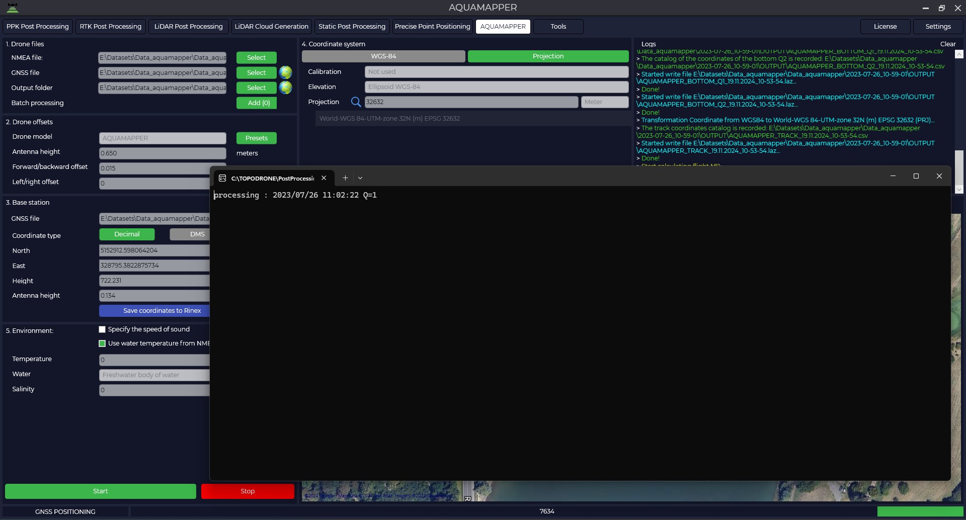
- To start processing, click the "Start" button. Data processing takes place simultaneously in the forward and reverse directions, and the solution type is displayed as the letter " Q " with a number: Q1 — fixed solution, Q2-floating solution, Q5-no solution.

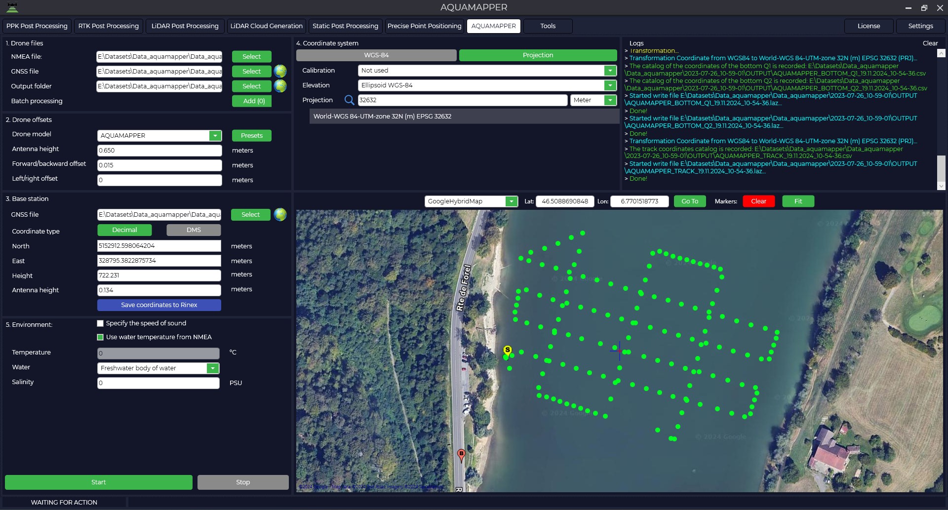
- As a result of processing, the AQUAMAPPER trajectory will be displayed on the screen and a set of files will be generated.


|
|
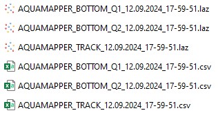
Data is written in two formats:*. laz and *. csv. Files with the TRACK prefix contain information about the trajectory, and files with the BOTTOM prefix contain information about the topography of the reservoir bottom. |
Two graphs will also be displayed: the upper graph shows the slope of the bathymetric sensor at a certain point in time, and the lower graph shows the depth. 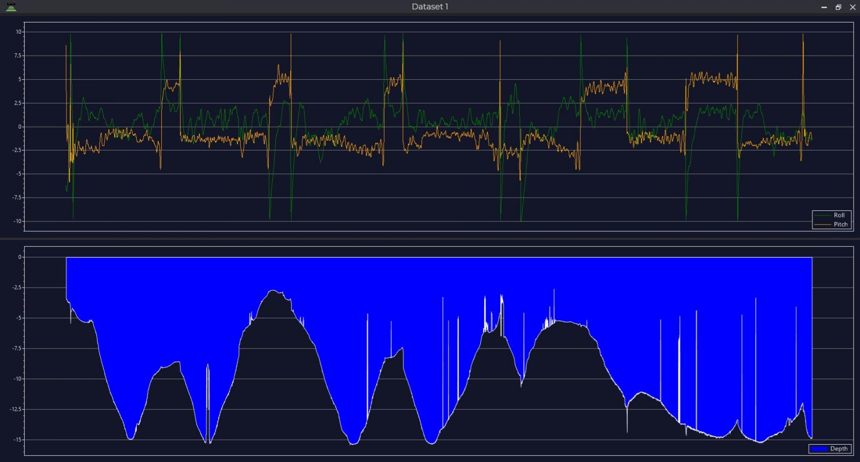
Then, based on the data obtained, you can build a depth map.

No Comments