
Precise Point Positioning
Precise Point Positioning (PPP) — is a global navigation satellite system positioning method that calculates coordinates with an error of only a few centimeters under good conditions. PPP is a combination of several relatively sophisticated GNSS positioning refinement methods. Unlike the RTK method, which uses a base station, a rover and relatively small distances between them, the PPP method uses a single GNSS receiver.
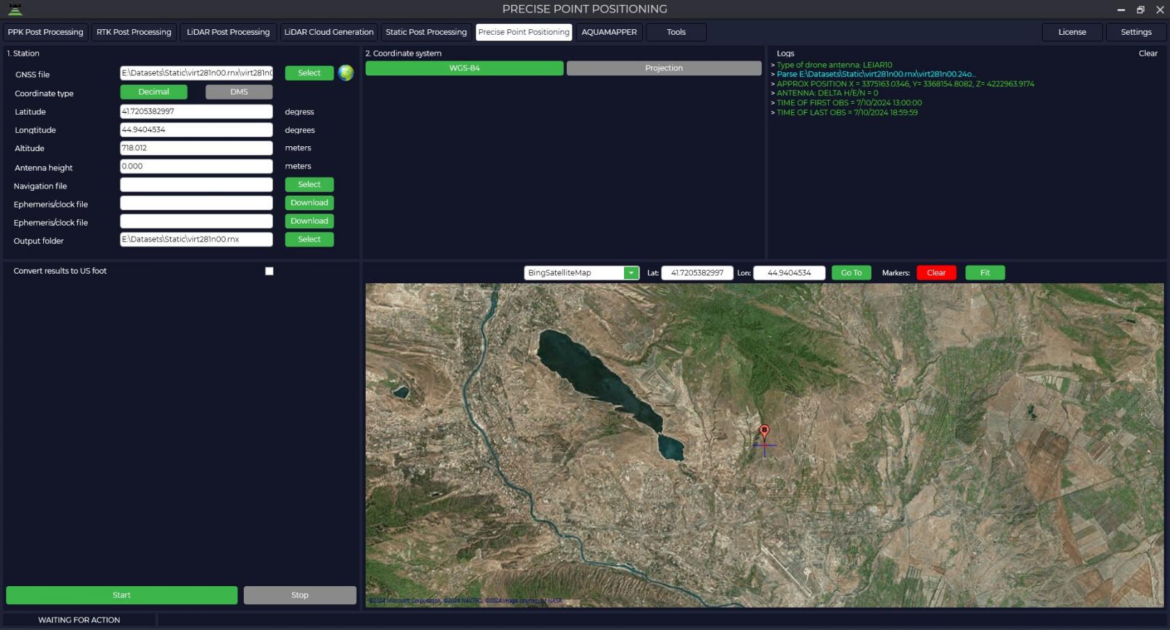
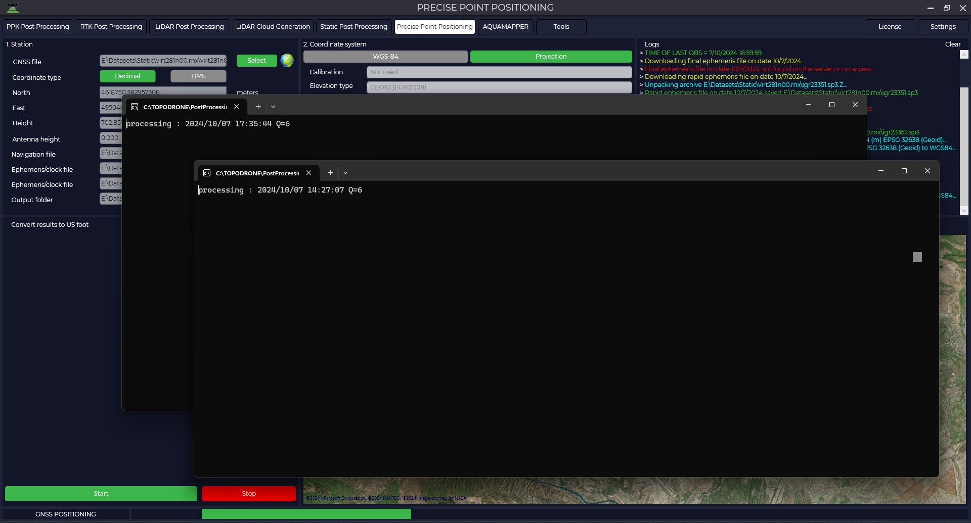
- Click on the Precise Point Positiong tab to use this module and click on the "Select" button to download data from the GNSS receiver. Supported formats: *.ubx, *.obs, *.rnx and *.*o.
- Next we need to upload the rest of the data.

Navigation file - navigation file of measurements in *.nav, *.rnx, *.n, *.p, *.g, *.h, *.q, *.c and *.l format. Ephemeris/clock file - final ephemeris file in *.sp3, *.eph format, it is also possible to upload exact on-board clock file *.clk. When you click on the Download button, if the data are available on the NASA server, the program will automatically download these data.
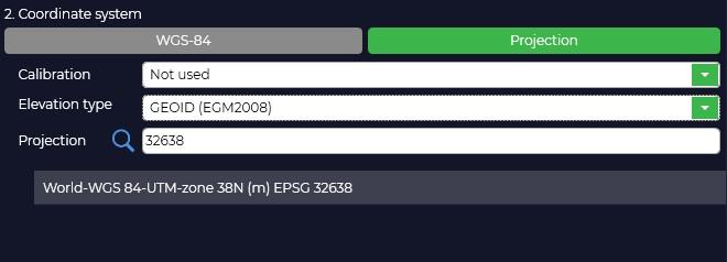
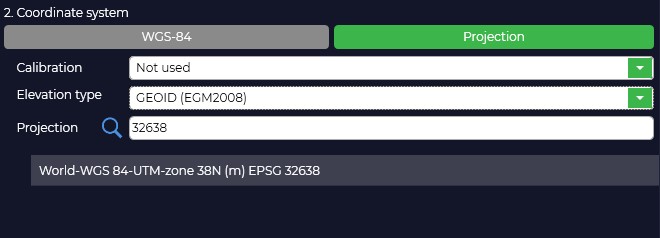
Output folder - folder with output data, it can be changed if necessary. - Select the coordinate and altitude system in which we need to get the coordinates of the point.
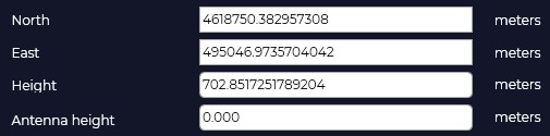
- Then, if data is available, enter the coordinates of the base station and the antenna height, taking into account the phase center.
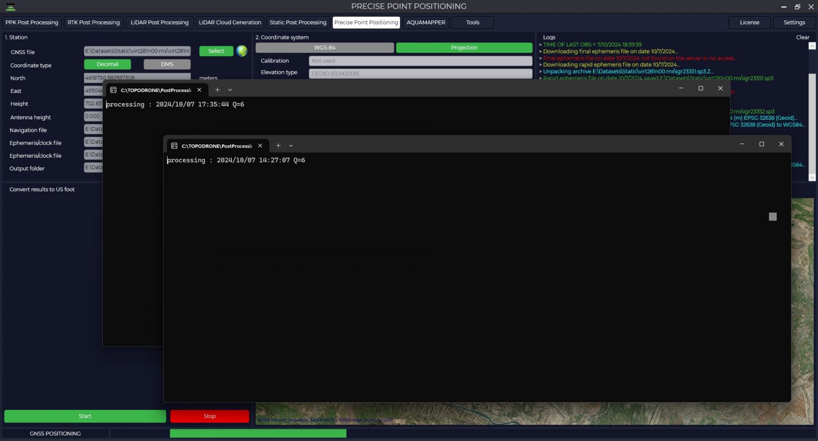
- When you click on the "Start" button, the program will start calculations.
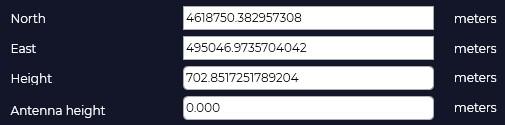
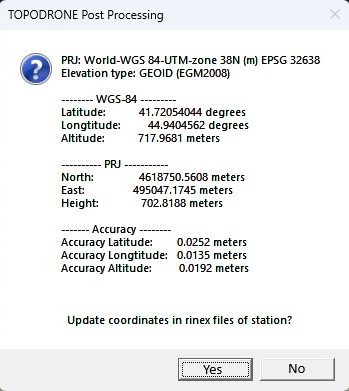
- As a result of calculations, a window will appear with the coordinates of the point in the WGS-84 coordinate system, in the selected coordinate system and the accuracy of these coordinates. Also, if you click on the "Yes" button, the program will write the calculated coordinates in the header of the rinex file.


No Comments